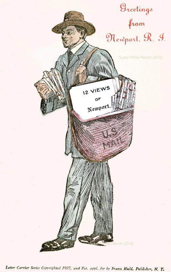
More scans of old postcards I have collected of places I have lived and liked.
[Click on an image for an enlarged view]
All images and text Copyright © 2001-2012 Susan White Pieroth
See this portion of a 1918 Newport Map to help locate sites.
|
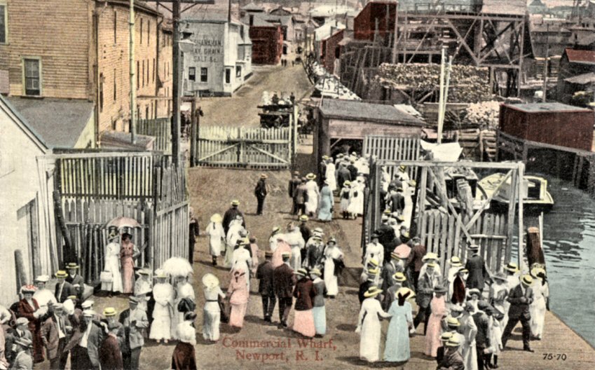
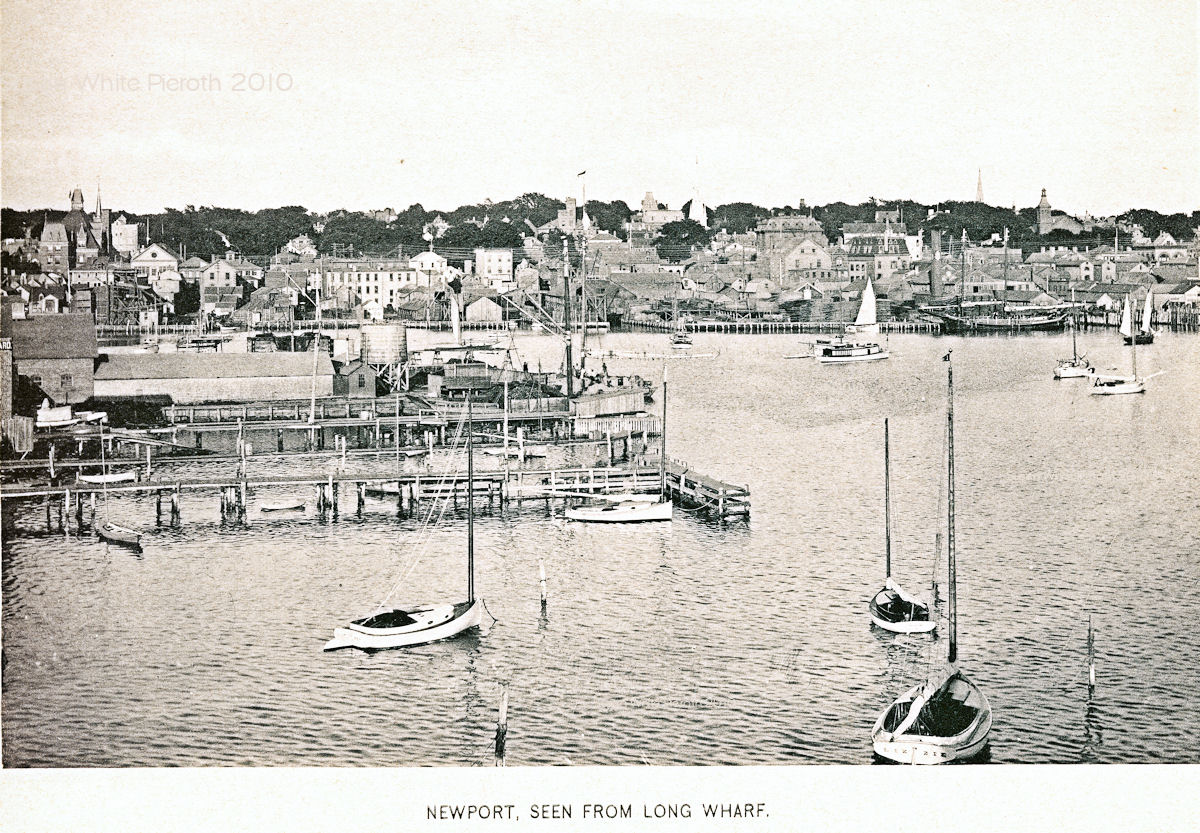 Left: Commercial Wharf. Left: Commercial Wharf.Right: 1897 view book picture of Newport from Long Wharf. |
 |
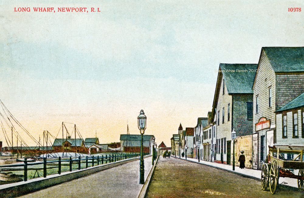 Left and
right:
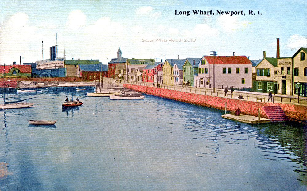
Long Wharf, Newport. This area was the center of activity a century ago
when this picture was probably taken. When you turn around you head
towards
Washington Square and the Brick Market will be on your right. Left and
right:
Long Wharf, Newport. This area was the center of activity a century ago
when this picture was probably taken. When you turn around you head
towards
Washington Square and the Brick Market will be on your right. |
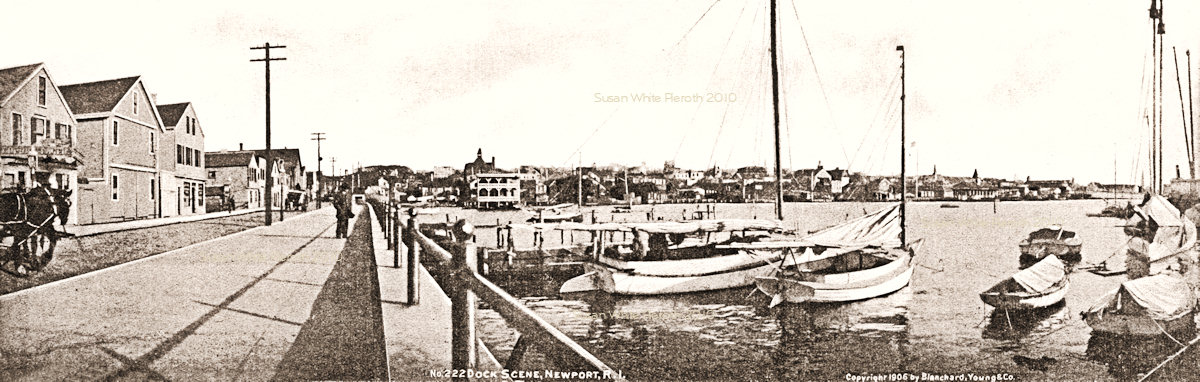 |
 Left:
A double card, "Dock
Scene" (Long Wharf) copyrighted 1906 by Blanchard, Young & Co.
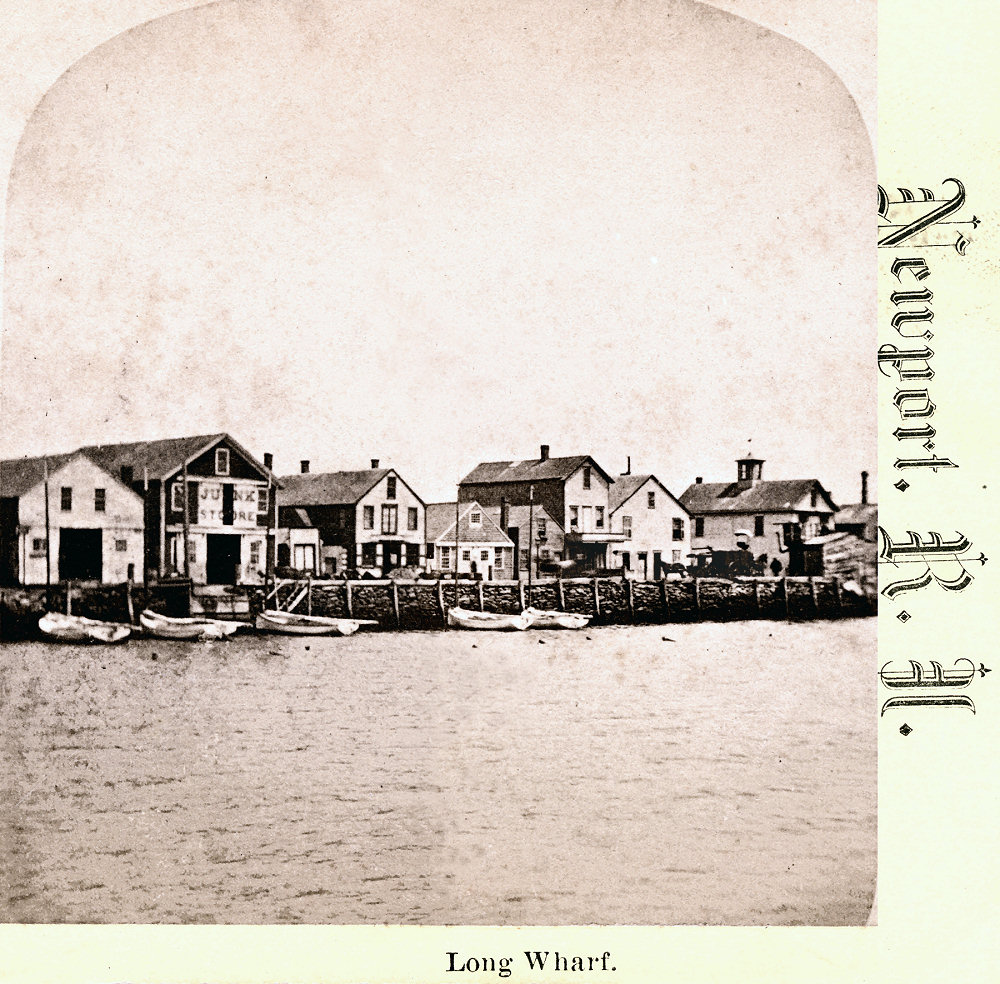
Right: An 1800's stereo card of Long Wharf, Newport, R.I. The second
building from the left says "Junk Store". Left:
A double card, "Dock
Scene" (Long Wharf) copyrighted 1906 by Blanchard, Young & Co.
Right: An 1800's stereo card of Long Wharf, Newport, R.I. The second
building from the left says "Junk Store". |
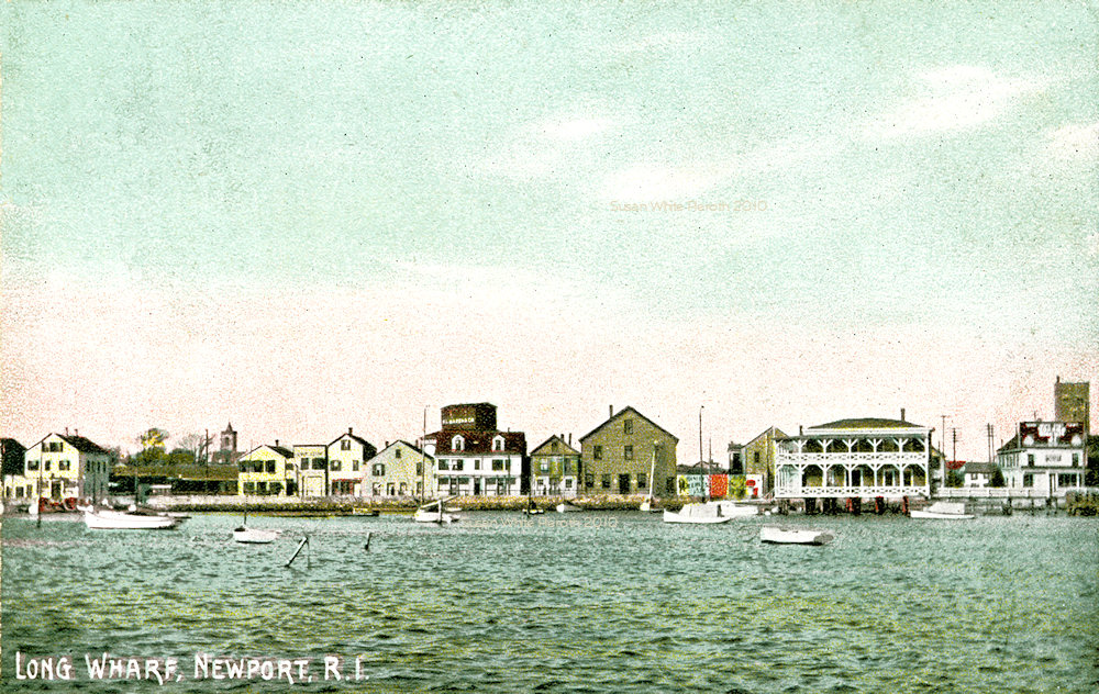 |
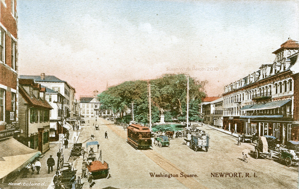
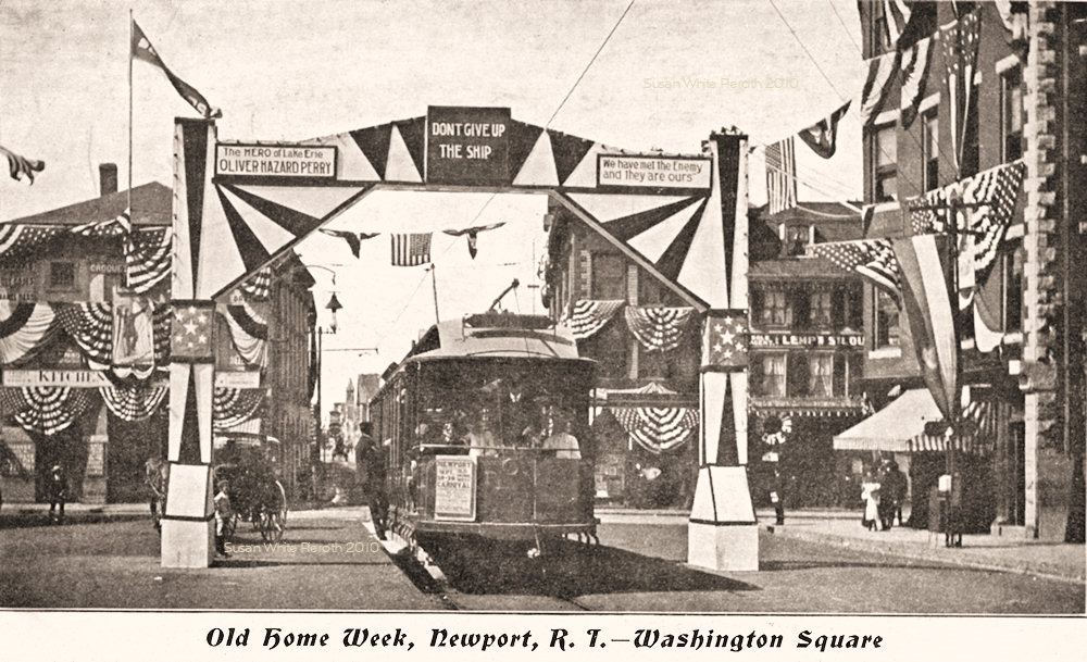 Left:
Long Wharf from the water. Left:
Long Wharf from the water.Right: Old Home Week (probably 1905) Washington Square. The trolley is coming from Long Wharf. The Brick Market is on the left. |
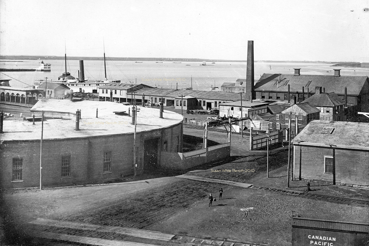 |
 Left: A photograph
of the
Washington Street / Long Wharf Fall River Line docks and the railroad
roundhouse (now long gone). Left: A photograph
of the
Washington Street / Long Wharf Fall River Line docks and the railroad
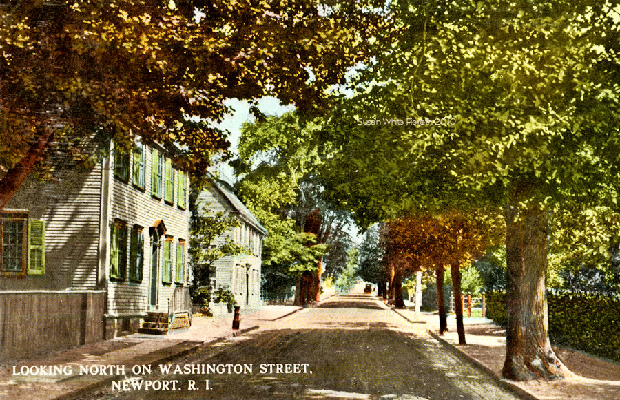
roundhouse (now long gone).Right Washington Street looking north. |
 |
 Left:
Washington
Square, 1906.
The Old Colony House is at the end and Touro Street on the right.
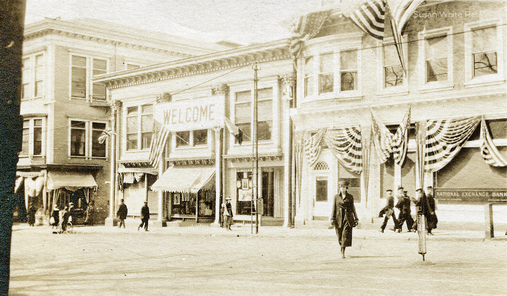
Right: The north side (left) in 1919. The National Exchange Bank is on
the right. Left:
Washington
Square, 1906.
The Old Colony House is at the end and Touro Street on the right.
Right: The north side (left) in 1919. The National Exchange Bank is on
the right. |
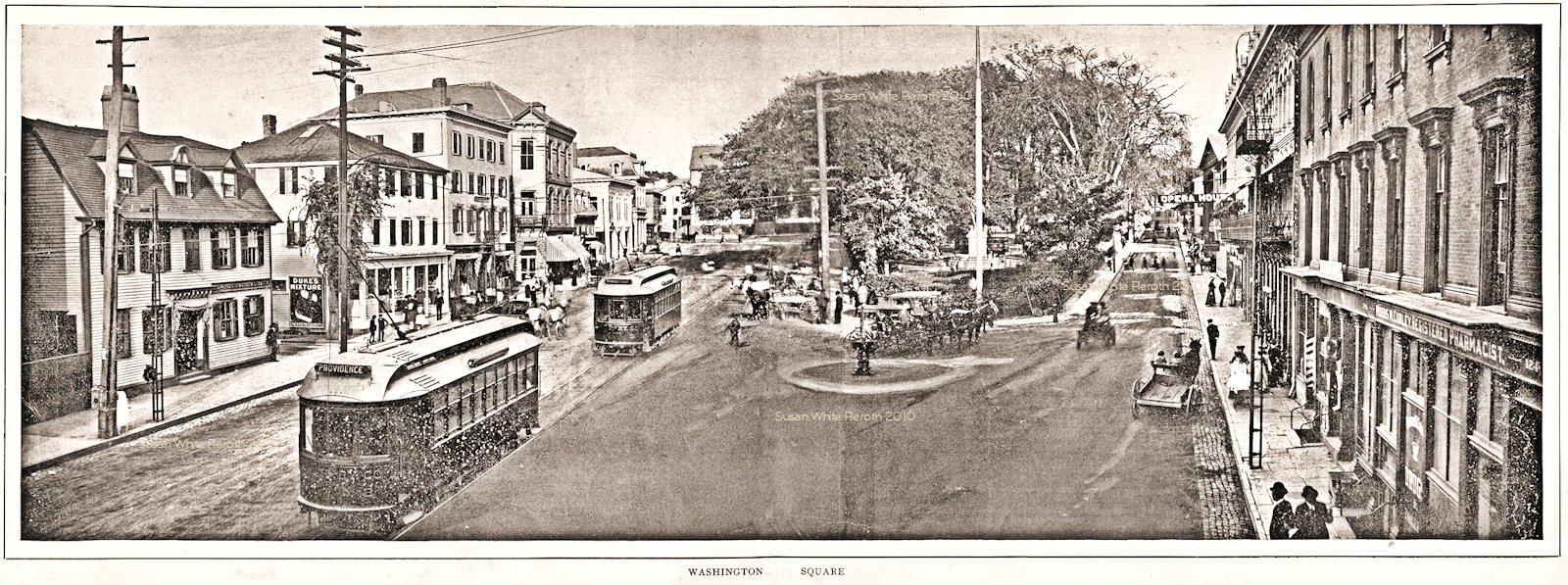 |
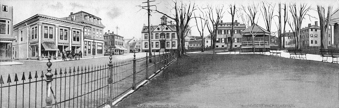
 A
double page
picture of Washington
Square from an old view book (also printed on a double wide
postcard). Click the image for an enlargement, click
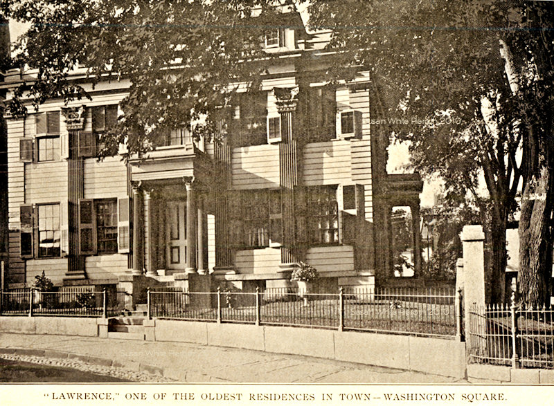
here for an even larger version. Right: from a view book, the Lawrence building in Washington Square. A
double page
picture of Washington
Square from an old view book (also printed on a double wide
postcard). Click the image for an enlargement, click
here for an even larger version. Right: from a view book, the Lawrence building in Washington Square. |
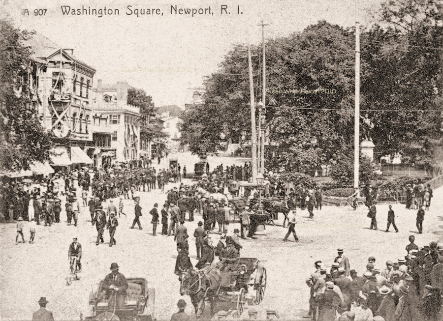 |
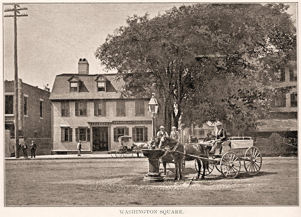 Left:
an early card of Washington Square on a very busy day. Prior to being
printed as a postcard, this image was published in a 1904 book. Left:
an early card of Washington Square on a very busy day. Prior to being
printed as a postcard, this image was published in a 1904 book.Right: Horse fountain and Newport National Bank, 1897. The bank is still there with a different name, but the the building to the left has changed several times. In the stereo view below left is a previous structure. |
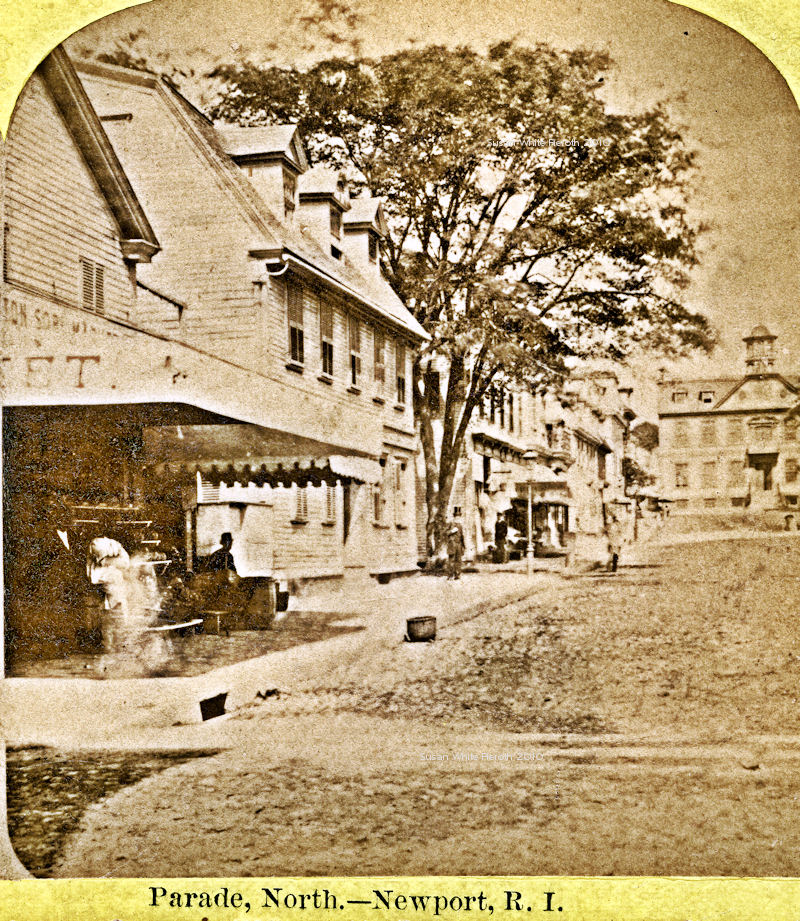 |  Left:
A stereo card view of the north side of Washington Square (The Parade).
The first building on the left was replaced several times: first by the
building seen above left and then by the one in the card at the right.
The second building is still there. Left:
A stereo card view of the north side of Washington Square (The Parade).
The first building on the left was replaced several times: first by the
building seen above left and then by the one in the card at the right.
The second building is still there.Right: Washington Square with the Perry House on the right. |
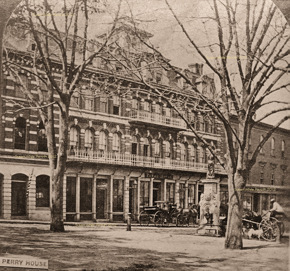 |
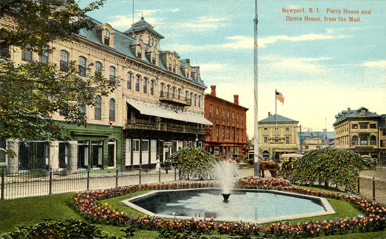 Left: Perry House from a stereo card. One sign advertises "Telegraph." Right: "Perry
House and Opera House, from the Mall." This is the opposite end of Washington
Square from the Colony House. The building at the end with the flag is
the Brick Market with a "Souvenirs" sign. The sign to the right says,
"Gladding
Print." Left: Perry House from a stereo card. One sign advertises "Telegraph." Right: "Perry
House and Opera House, from the Mall." This is the opposite end of Washington
Square from the Colony House. The building at the end with the flag is
the Brick Market with a "Souvenirs" sign. The sign to the right says,
"Gladding
Print." |
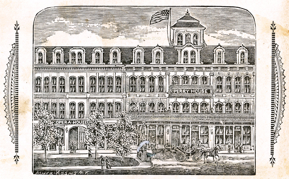 |
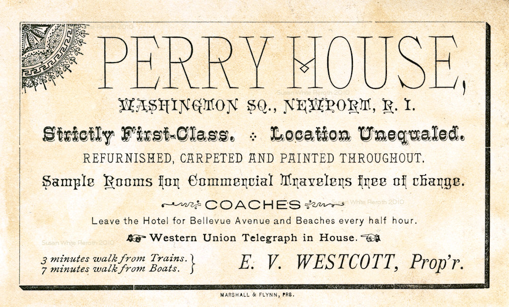 Left:
Engraving by Asher Adams of N.Y of Perry
House on the back of a trade/business card. Right: the face listing
it's convenience and first-class accommodations that are, "Furnished,
carpeted and painted throughout." E. V. Westcott, Proprietor. It was
named for Commodore Perry and torn down during the 1920's. Left:
Engraving by Asher Adams of N.Y of Perry
House on the back of a trade/business card. Right: the face listing
it's convenience and first-class accommodations that are, "Furnished,
carpeted and painted throughout." E. V. Westcott, Proprietor. It was
named for Commodore Perry and torn down during the 1920's. |
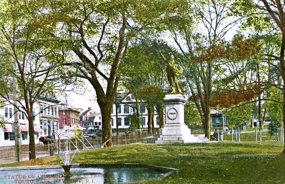 |
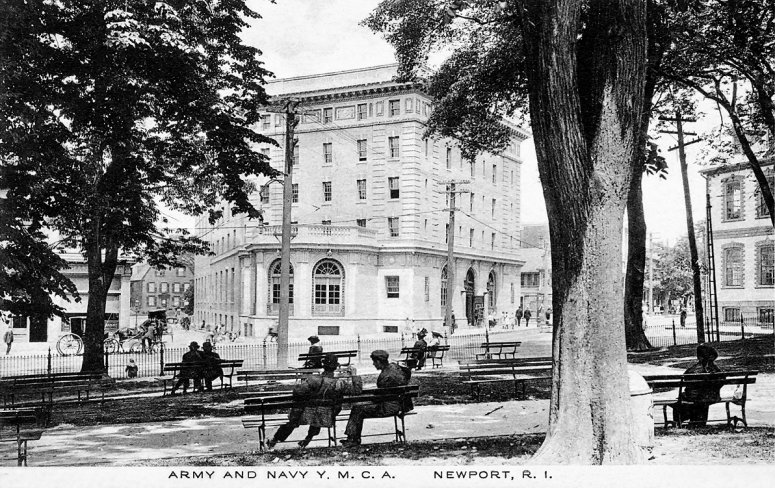
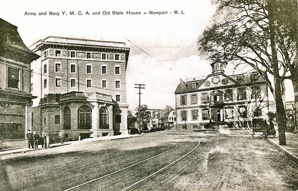 Left:
The Oliver Hazard Perry statue (dedicated in 1885) and the Old State House (Old Colony House) in the
background - before the Army and Navy Y.M.C.A was built. It's
incorrectly labeled Touro Park. Left:
The Oliver Hazard Perry statue (dedicated in 1885) and the Old State House (Old Colony House) in the
background - before the Army and Navy Y.M.C.A was built. It's
incorrectly labeled Touro Park.Right: The YMCA and the Old State House, probably soon after construction. |
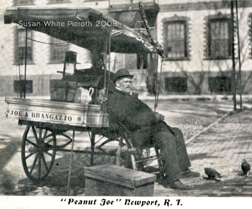 |
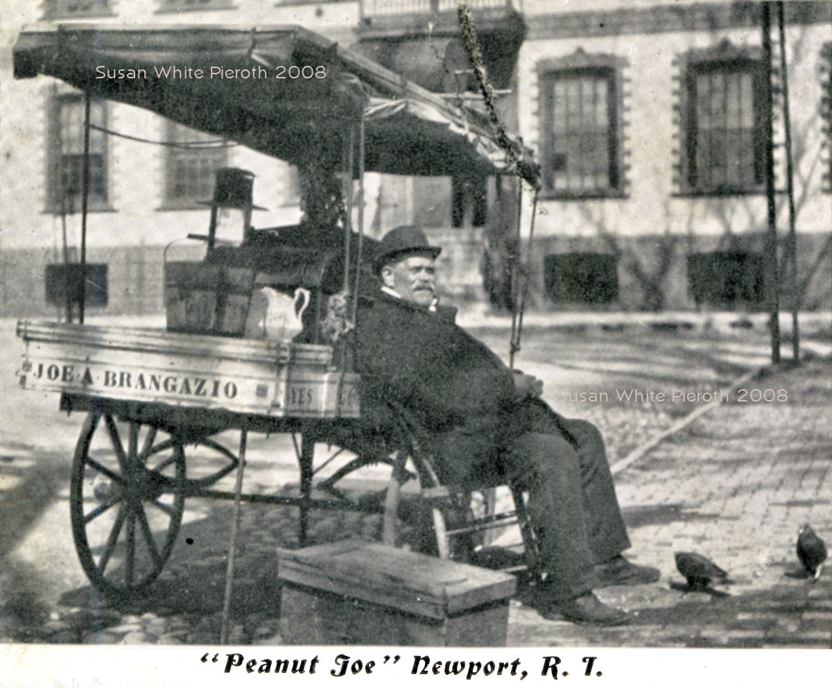
 Left: "Peanut
Joe" in front of the State House. He was a fixture in
Washington Square. The cart says,
"Joe A. Brangazio." For a larger size click here.
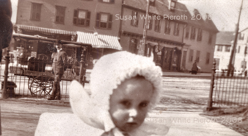
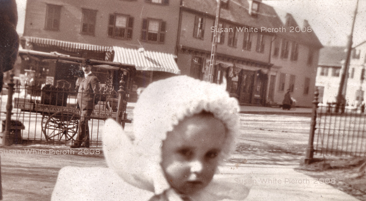
Right: A family photo about 1906 showing the peanut cart. On
the side it says, "Yes. Good Peanuts. Best In The
World." For a larger size click here.
The buildings in the background have changed - see below. Left: "Peanut
Joe" in front of the State House. He was a fixture in
Washington Square. The cart says,
"Joe A. Brangazio." For a larger size click here.
Right: A family photo about 1906 showing the peanut cart. On
the side it says, "Yes. Good Peanuts. Best In The
World." For a larger size click here.
The buildings in the background have changed - see below. |
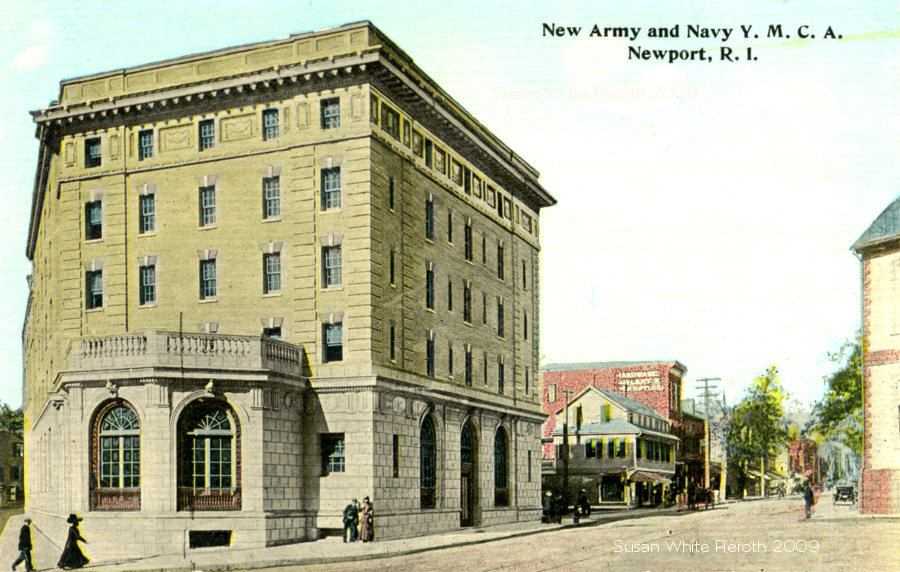 |
 Left
top: New Army and Navy Y.M.C.A. with Broadway behind. It closed in the
early 1970's and was refurbished in the late 1980's. The first
building is the same as the first on the left in old photo below,
right. Right: "Army and Navy
Y. M.
C. A." published by Chas. d. Dadley, 186 Thames St., Newport. At the
far
right is the Colony House. This is the other side of Washington Square from
the Perry House and Opera House. Left
top: New Army and Navy Y.M.C.A. with Broadway behind. It closed in the
early 1970's and was refurbished in the late 1980's. The first
building is the same as the first on the left in old photo below,
right. Right: "Army and Navy
Y. M.
C. A." published by Chas. d. Dadley, 186 Thames St., Newport. At the
far
right is the Colony House. This is the other side of Washington Square from
the Perry House and Opera House. |
 | Left: is Broad Street (Broadway) as shown on an old Williams stereo card. The edge of the State House is on the right. Click here for a view of the State House (Old Colony House) before the YMCA was built. Right: in the photo taken in the late 1800's the first building on the left is Broadway Market - John B. Deblois Grocery store. The building is still there on the corner of Farewell. Click here to see an enlargement of the left side of the street. | 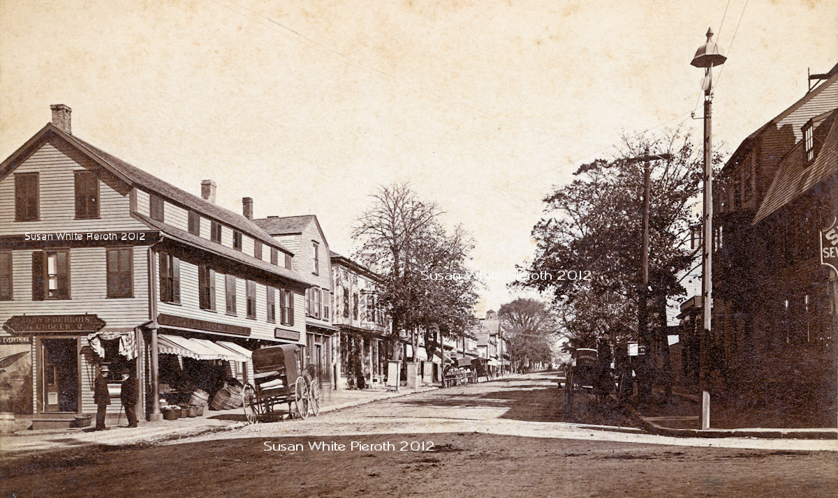 |
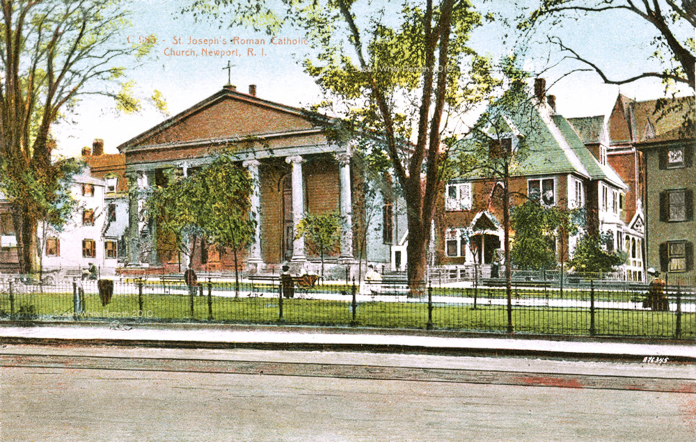 |
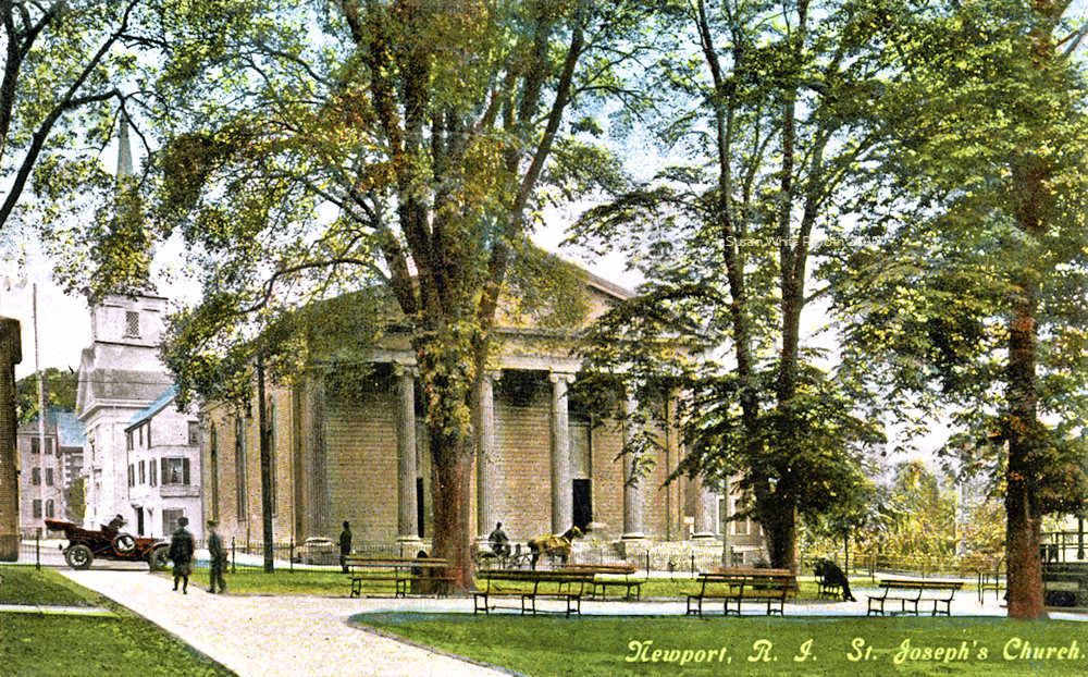 Left:
St. Joseph's
Roman Catholic Church, designed by Russell Warren, on Touro at the corner of Clarke Street. This is
up the street from the Perry
House and Opera House. It is now a theater. Left:
St. Joseph's
Roman Catholic Church, designed by Russell Warren, on Touro at the corner of Clarke Street. This is
up the street from the Perry
House and Opera House. It is now a theater.Right: the church with a view of Clarke Street and the Second Baptist Church. |
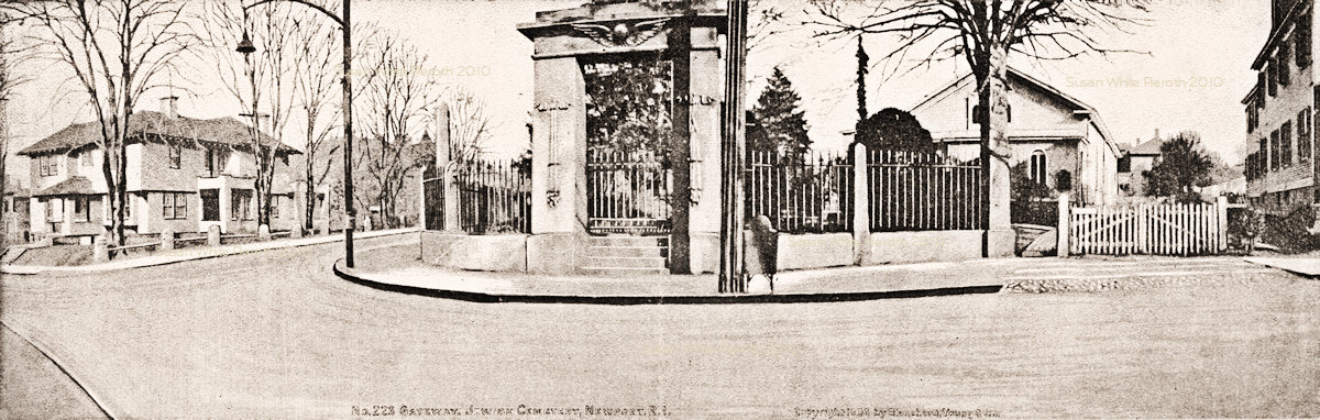 |
A double wide postcard, "Gateway, Jewish Cemetery" - part of Touro Synagogue. Copyrighted in 1906. |
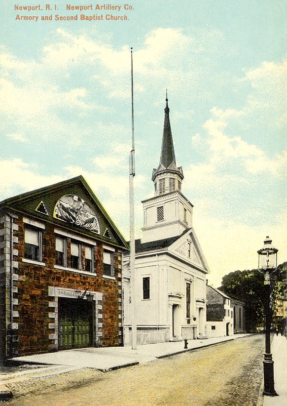 |
Clarke Street "Newport
Artillery Co.
Armory and Second Baptist Church." The church was later the Second
Congregational. Both buildings are still there and
in
use. The armory was originally built in 1835 and the second story added
after a fire in 1906. In 1946 the church steeple was modified. At the
end of the street is Touro Street.
|