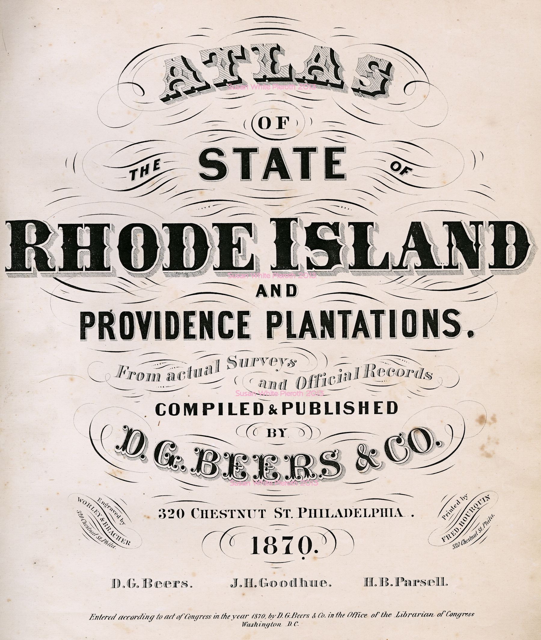
Atlas
of the State of Rhode Island and Providence Plantations
Compiled and Published by D. G. Beers & Co., Philadelphia, 1870
Rhode Island 1870 Atlas
Atlas of the State of Rhode Island and Providence Plantations
Compiled and Published by D. G. Beers & Co., Philadelphia, 1870
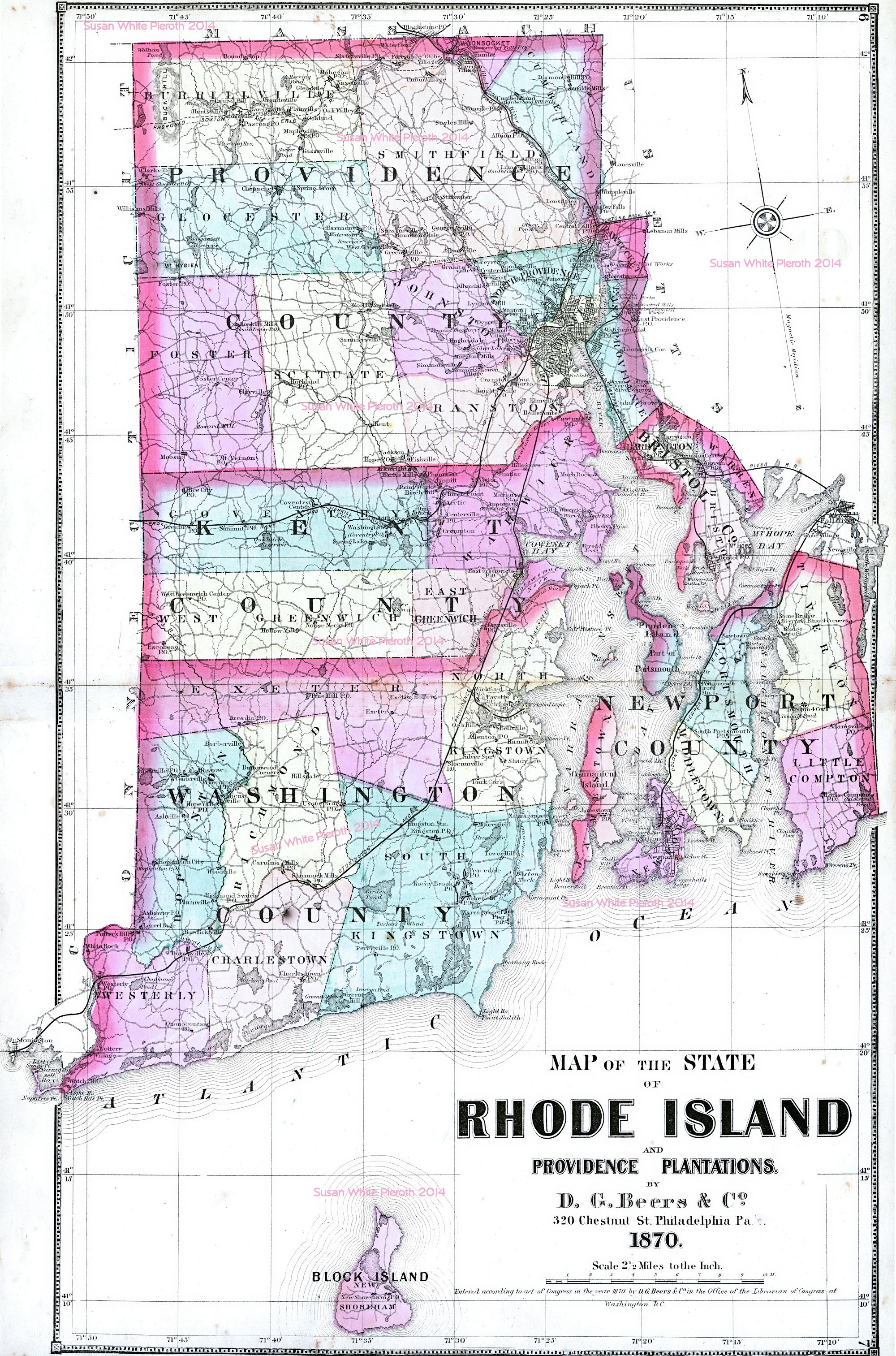
NOTE: Missing plate numbers are the blank sides of the maps. Each map, and section of map, has it's own scale.
 |
 |
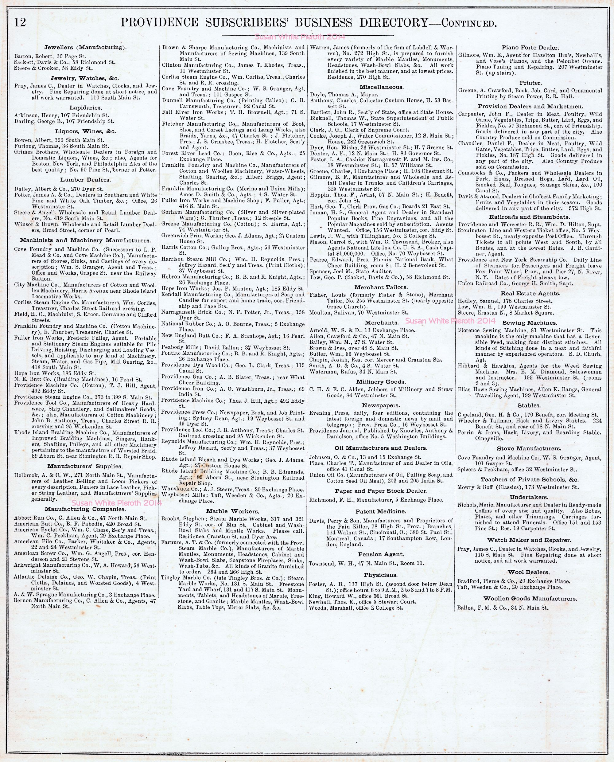 |
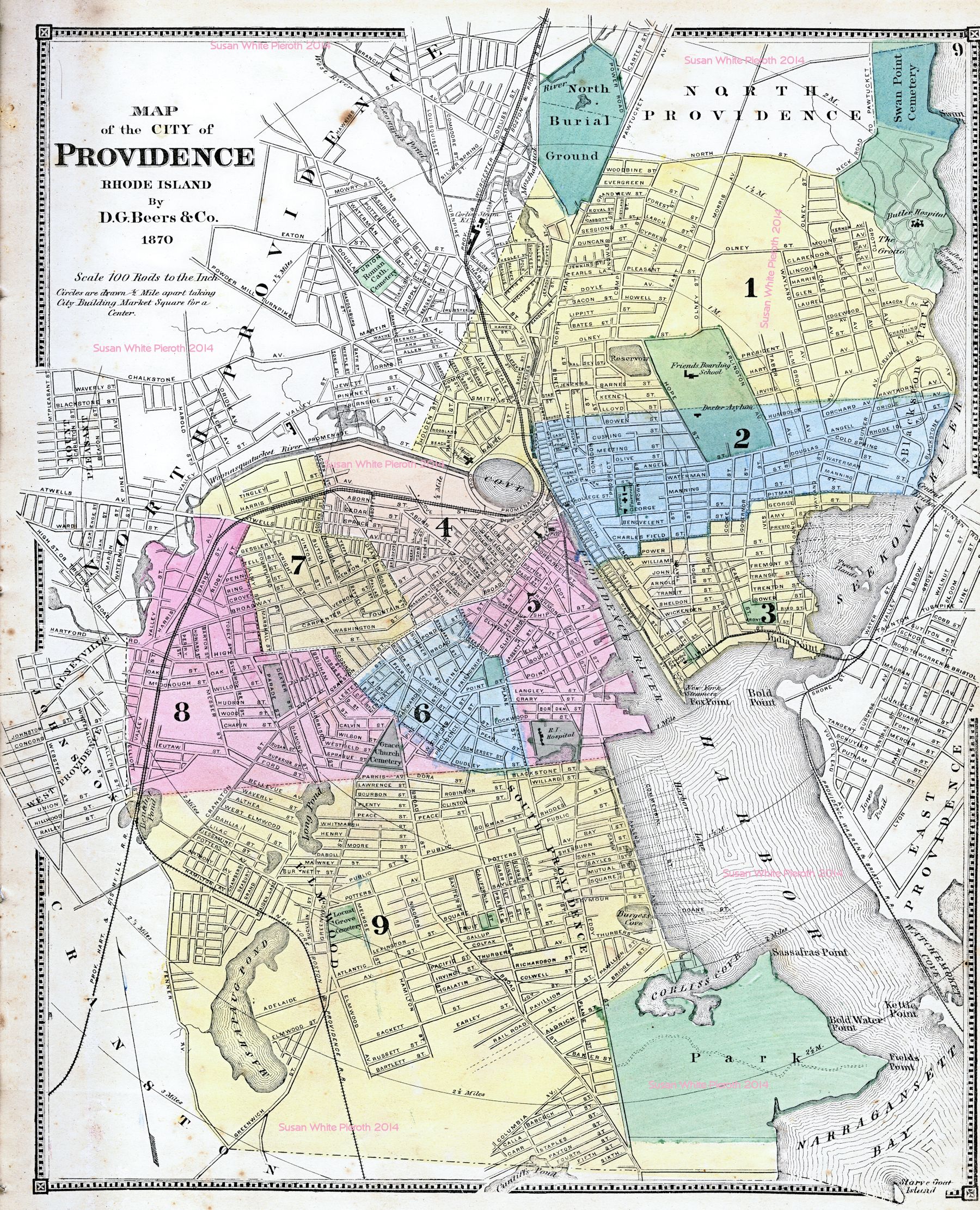
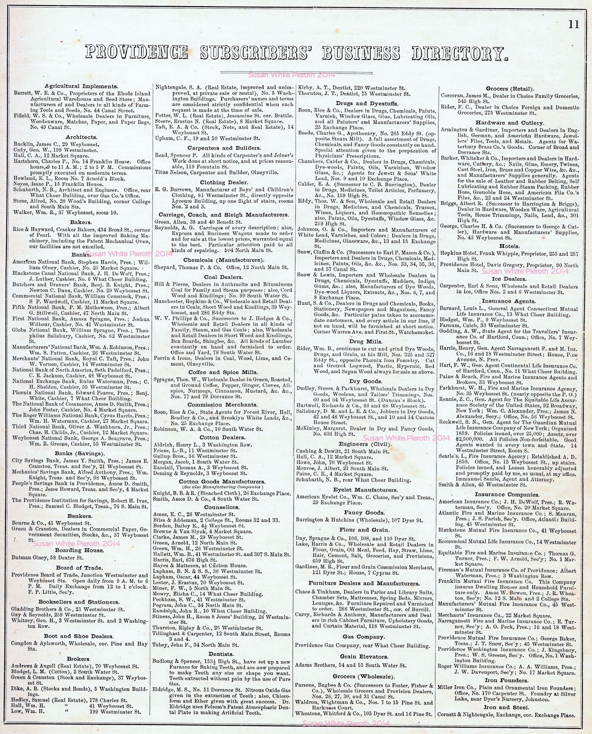
| The city of Providence. This map does not have buildings or names: page 9. Extra large image. | Providence Subscriber's Business Directory: Page 11 | Providence Subscriber's Business Directory: Page 12 |
 |
 |
 |
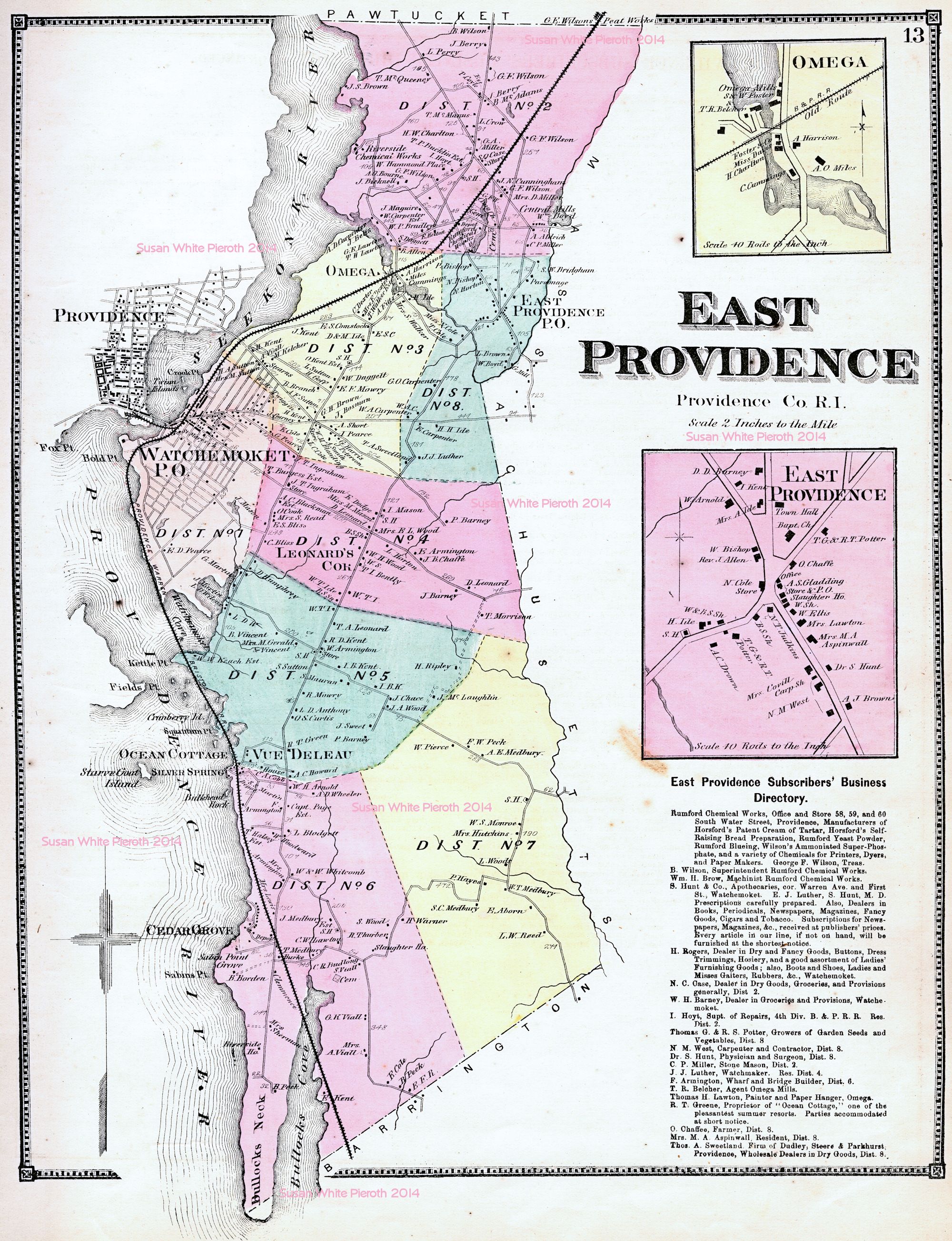
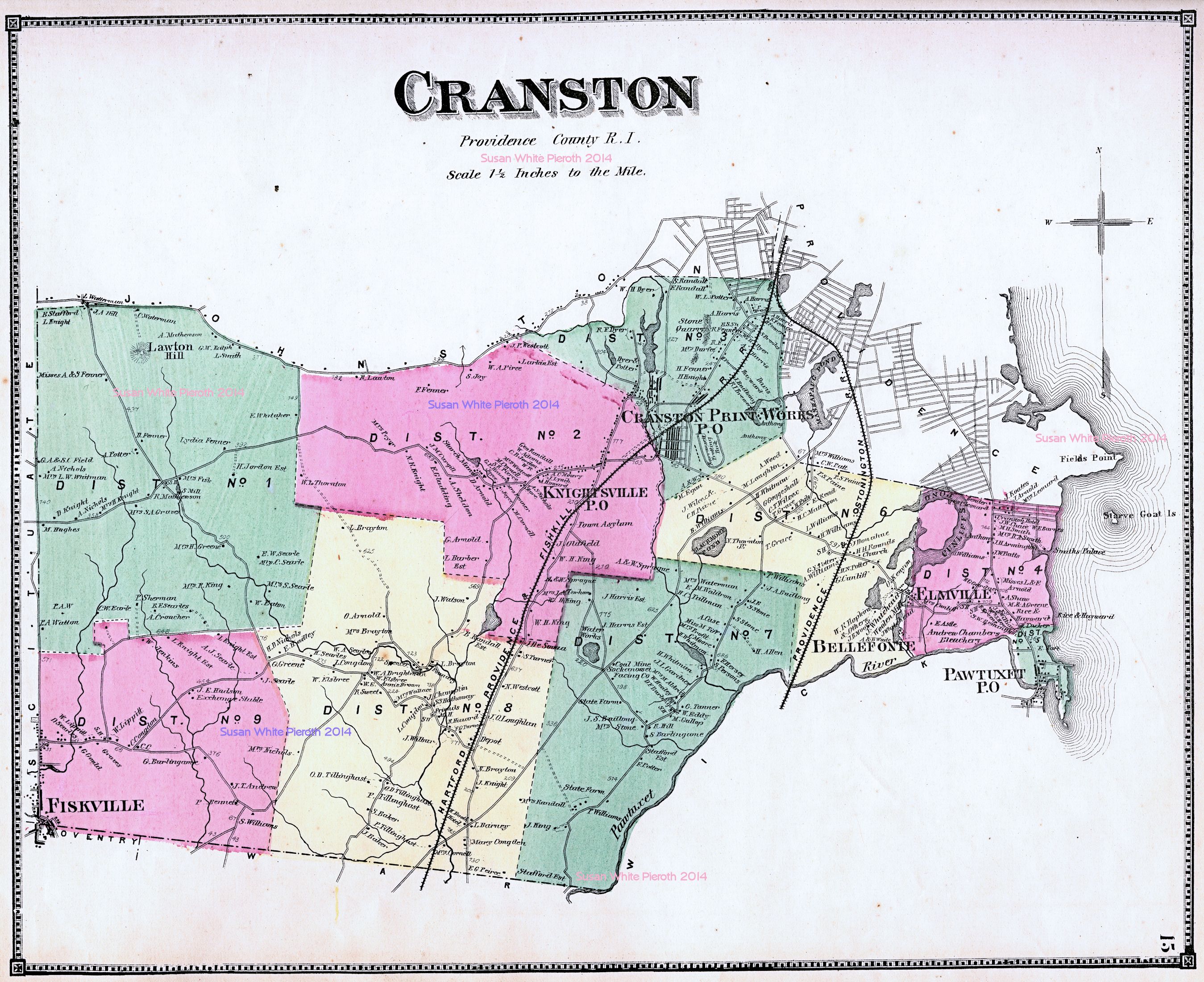
| East Providence, including an enlargement of Omega: page 13 | Cranston: page 15 | Pawtuxet, Cranston Print Works, Knightsville: page 17 |
 |
 |
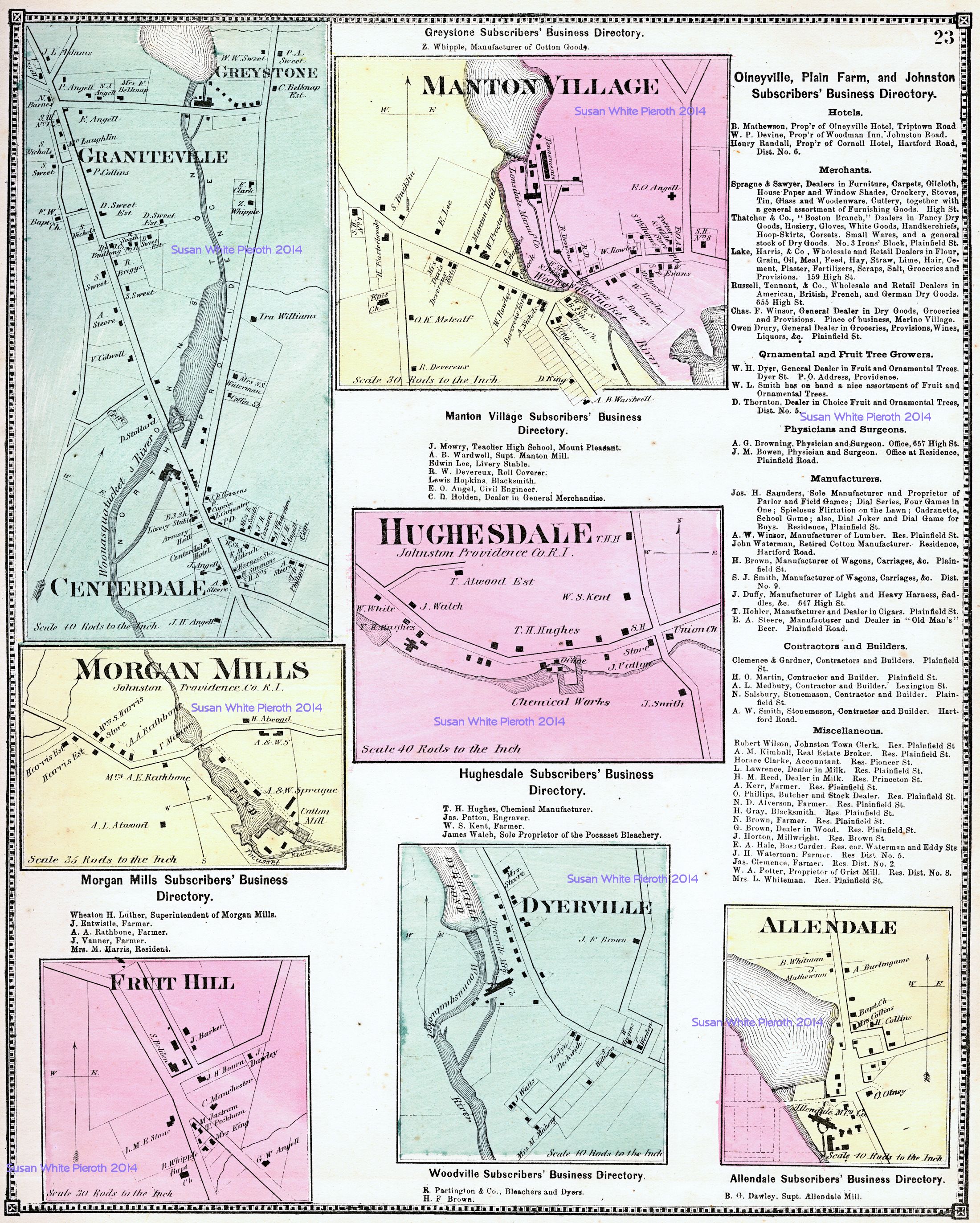 |
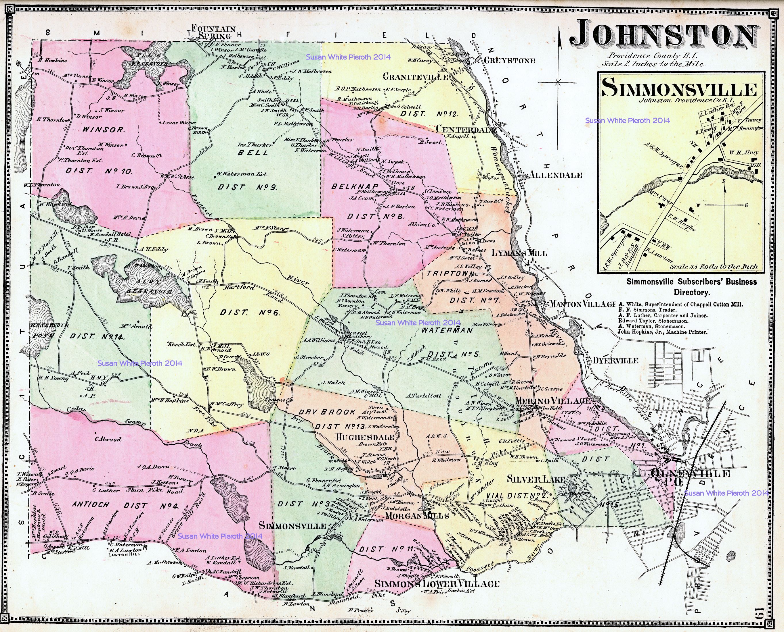
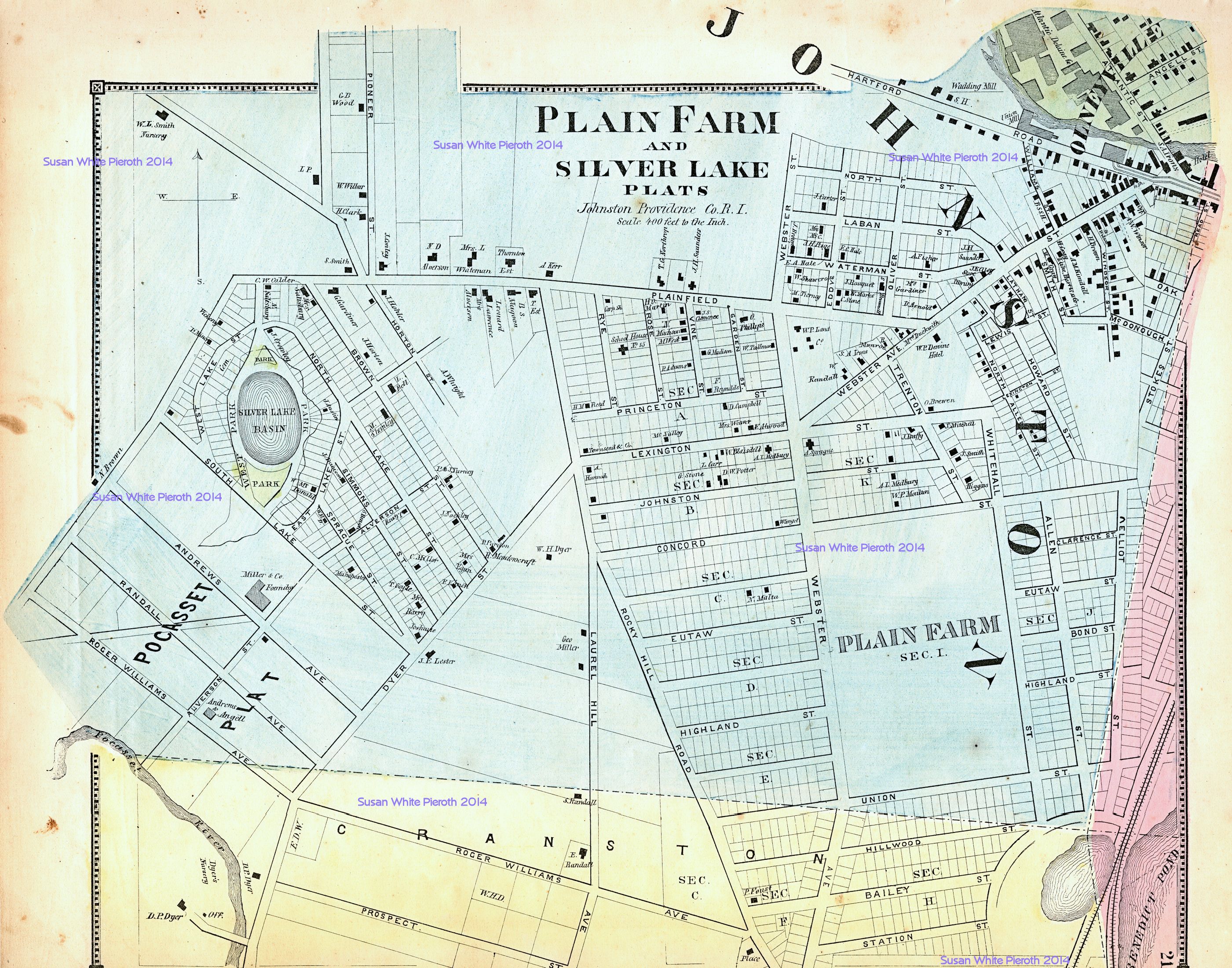
| Johnston Township, including enlargement of Simonsville: page 19 | Olneyville, Plain Farm and Silver Lake Plats, Johnston Township: page 21 | Grantteville, Centerdale, Morgan Mills, Fruit Hill, Manton Village, Hughesdale, Dyerville, Allendale: page 23 |
 |
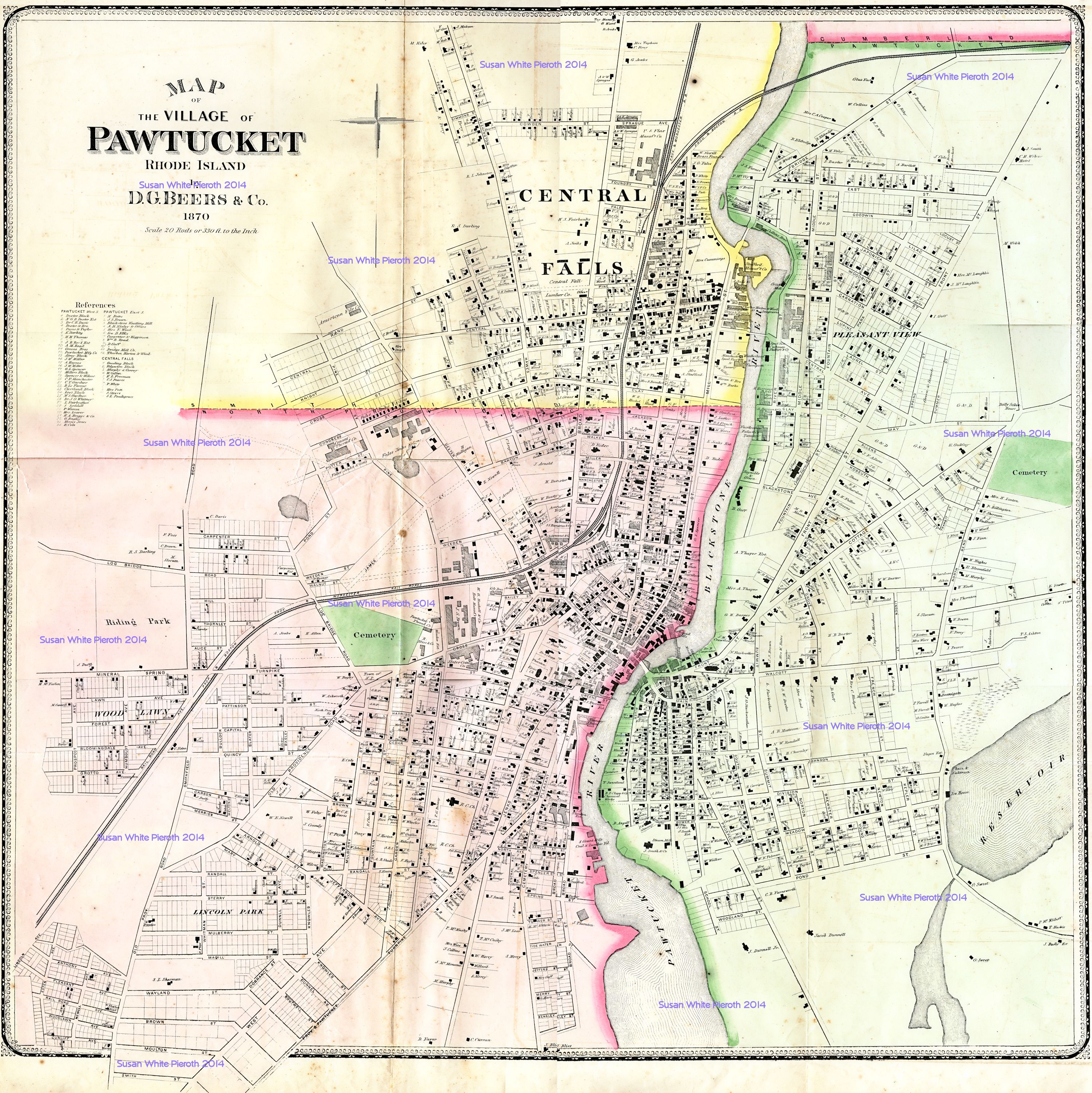 Village of Paswtuket, Central Falls: pages 28-29. Scanned in six section: Top left; top right; center left; center right; bottom left; bottom right. |
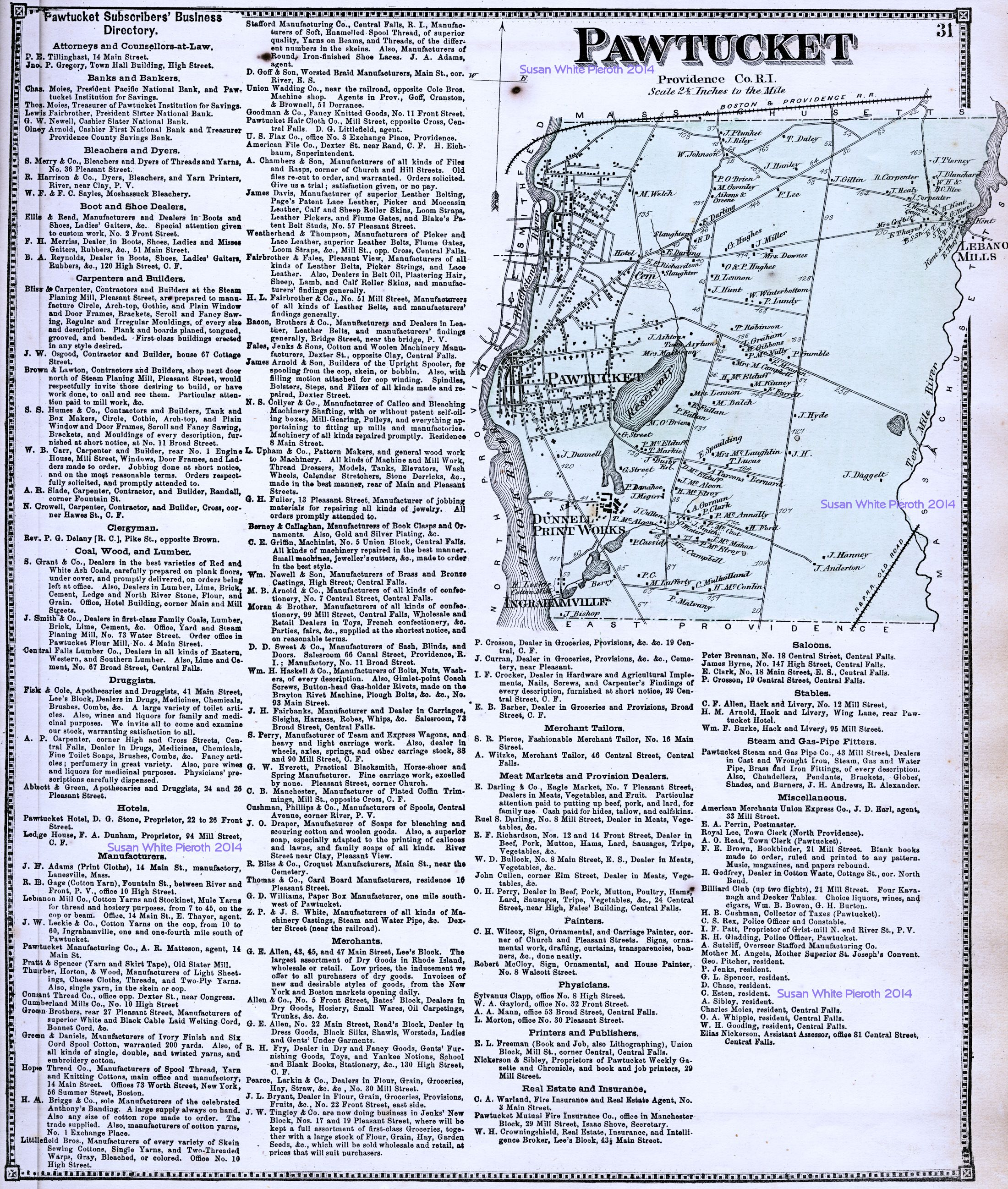 |
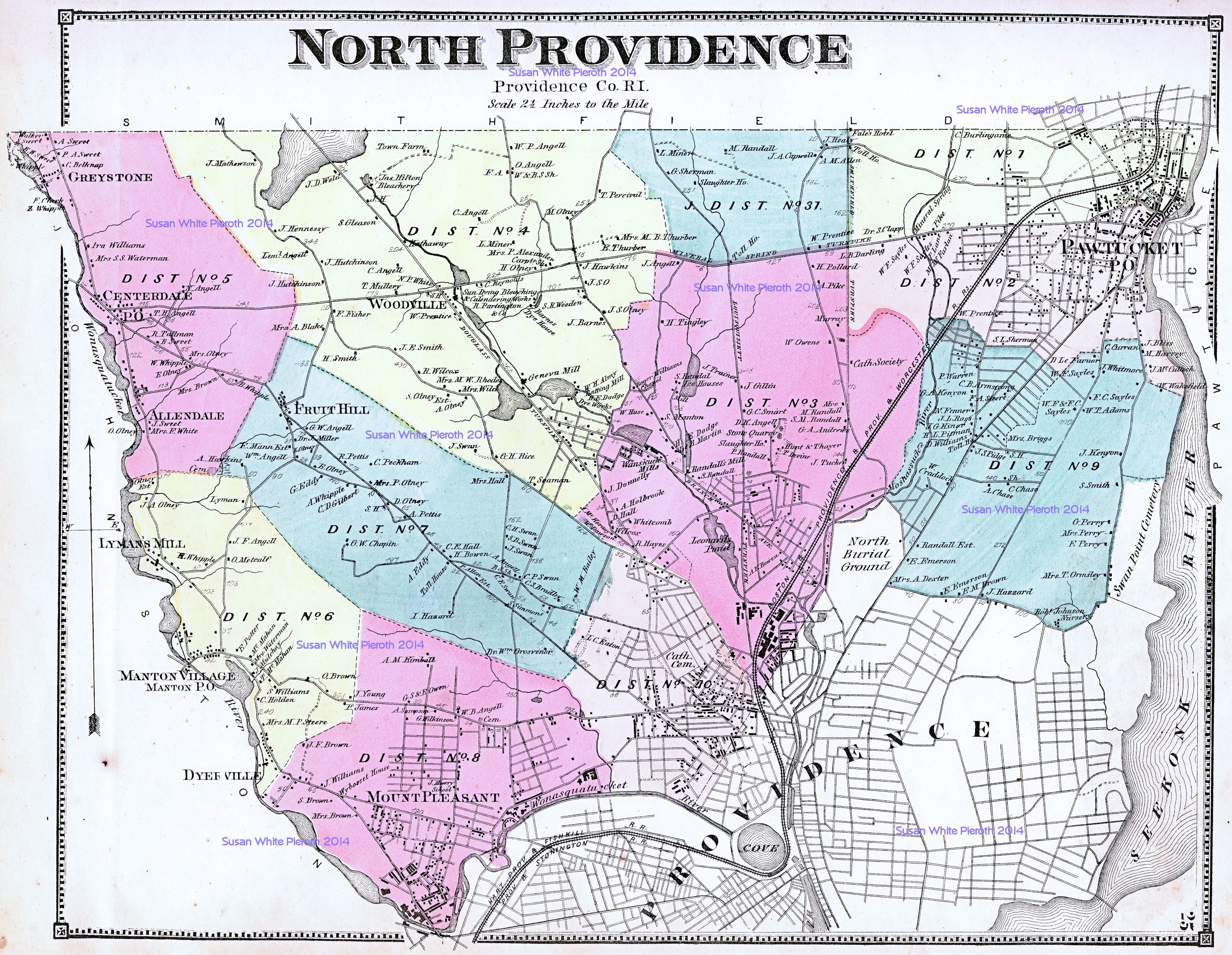
| North Providence: page 25 | Pawtucket: map portion: page 31 | |
 |
 |
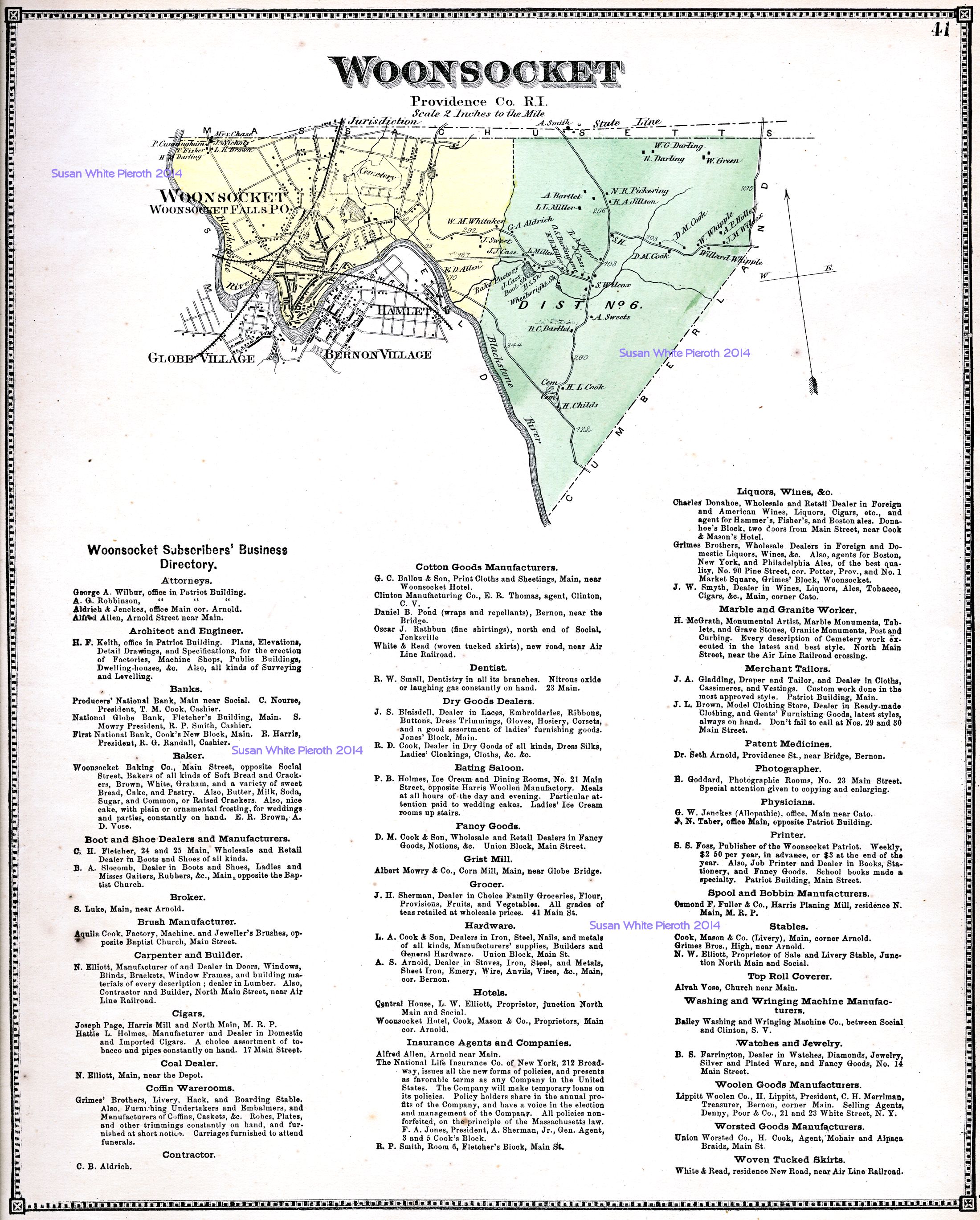 |
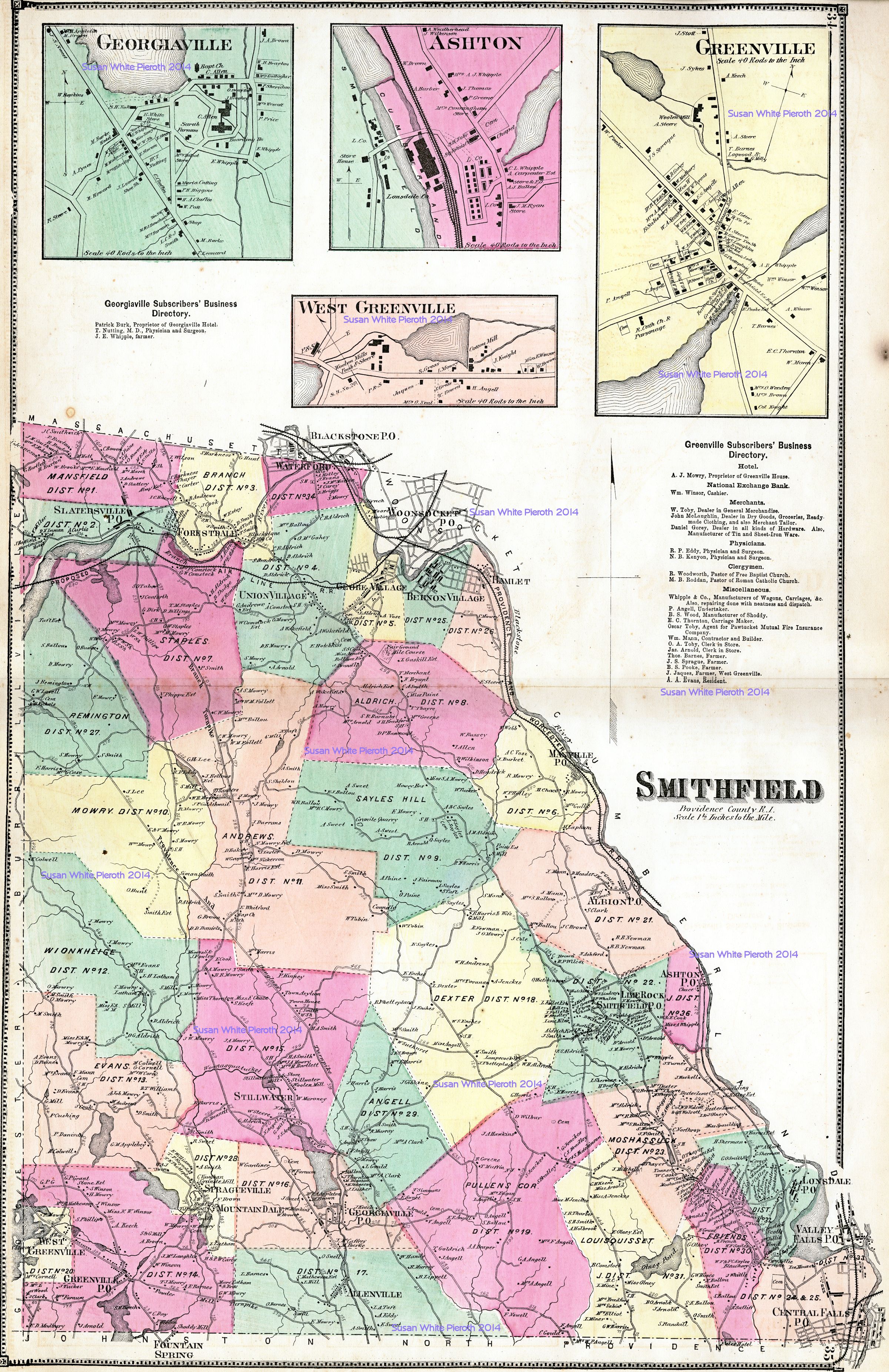
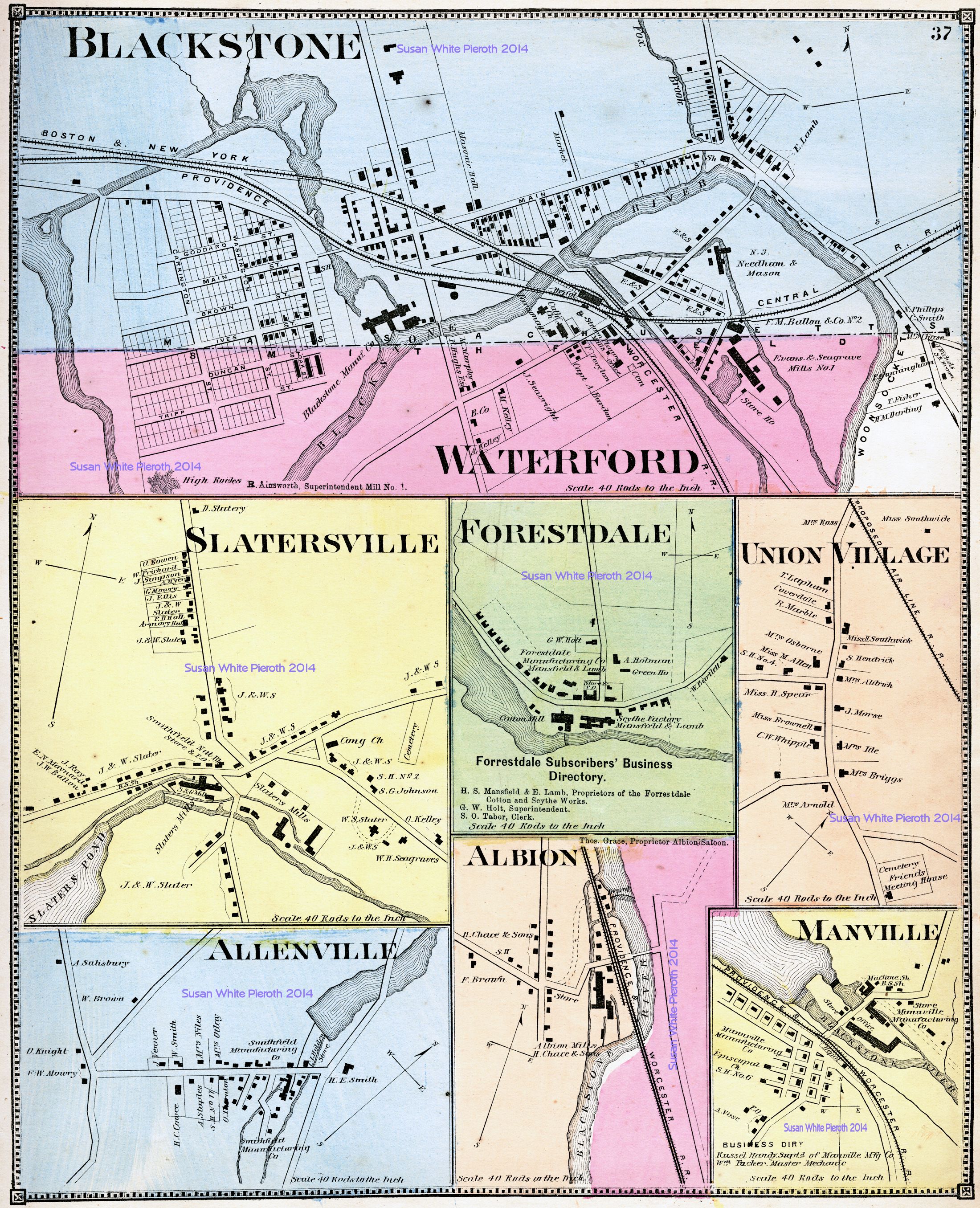
| Smithfield, including enlargements of Ashton, Georgiaville, Greenville, and West Greenville: double page 34 and 35 | Albion, Allenville, Blackstone, Forestdale, [Forrestdale], Manville, Union Village, and Waterford: page 37 | Woonsocket: page 41 |
 |
 |
 |
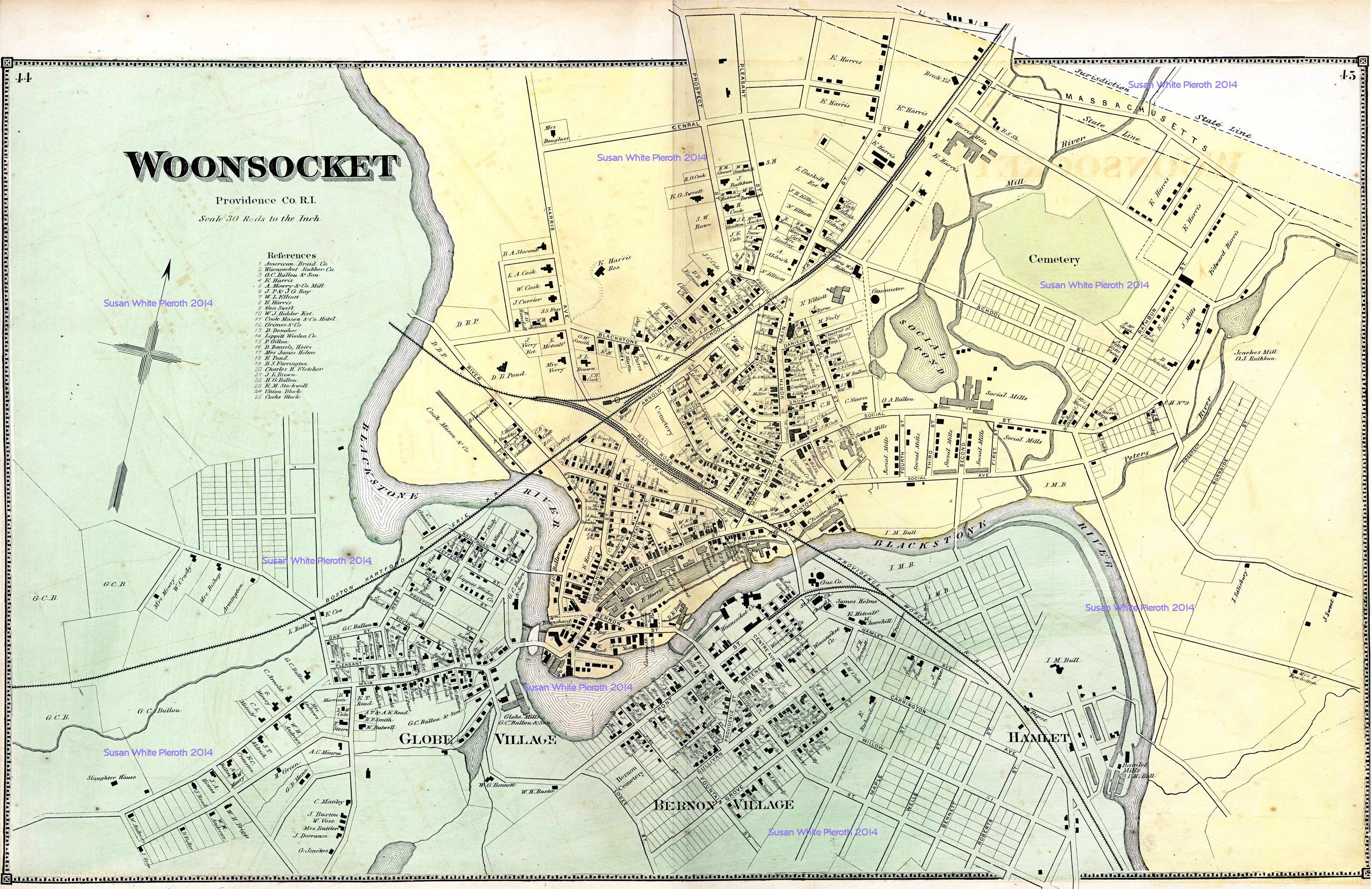
| Woonsocket: page
44 and 45 |
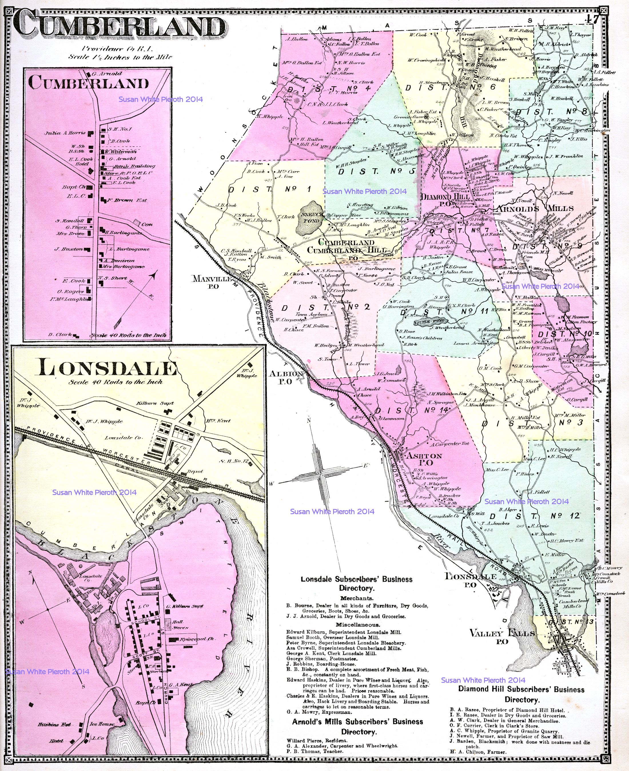
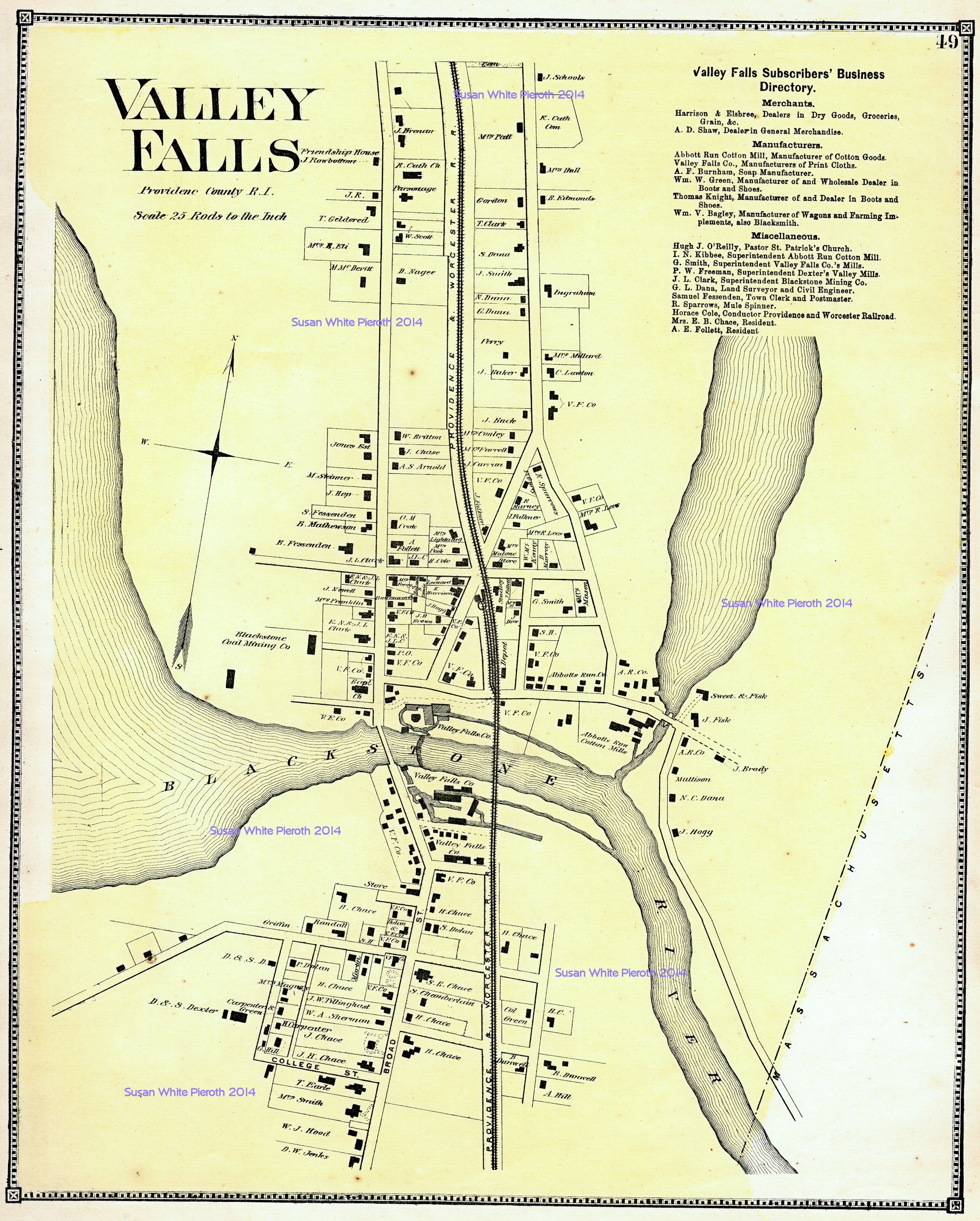
Cumberland, including enlargements of Cumberland and Lonsdale: page 47 | Valley Falls: page 49 |
 |
 |
 |
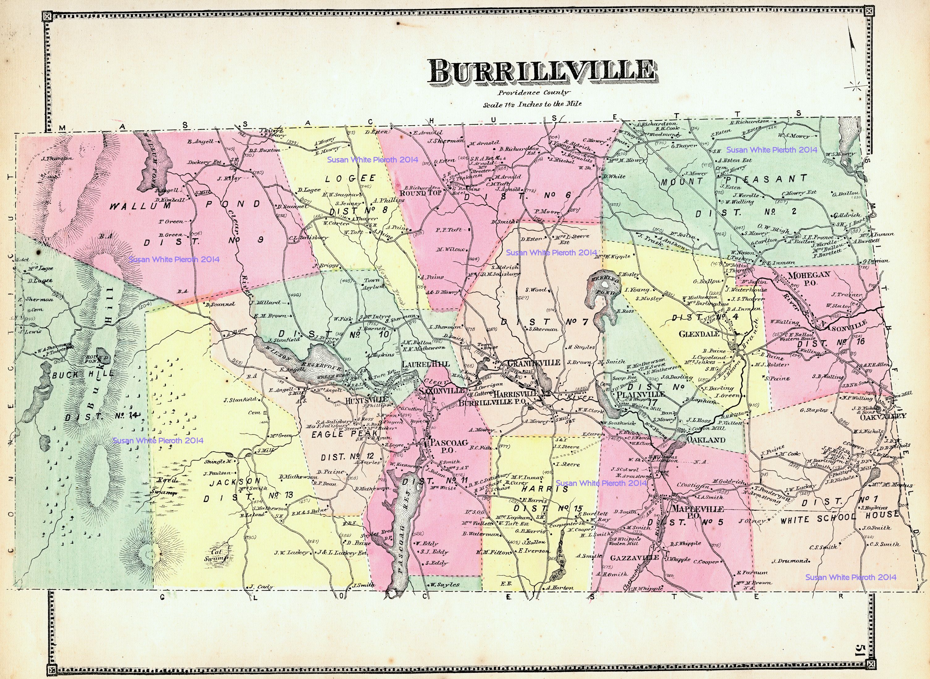
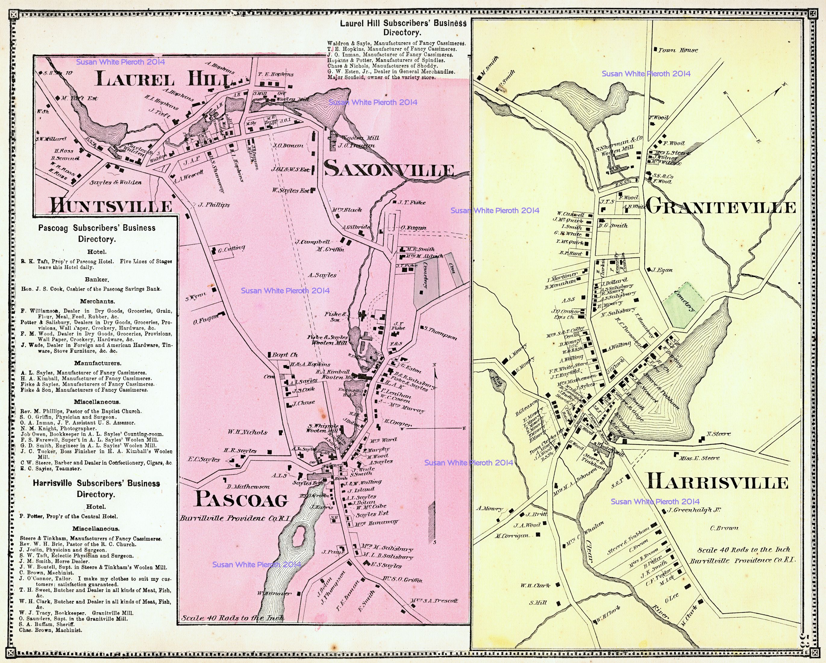
| Burrillville: page 51 | Graniteville, Harrisville, Huntsville, Laurel Hill, Pascoag, Saxonville: page 53 | Chepachet, Glendale, Harmony, Mapleville, Mohegan, Nasonville: page 55 |
 |
 |
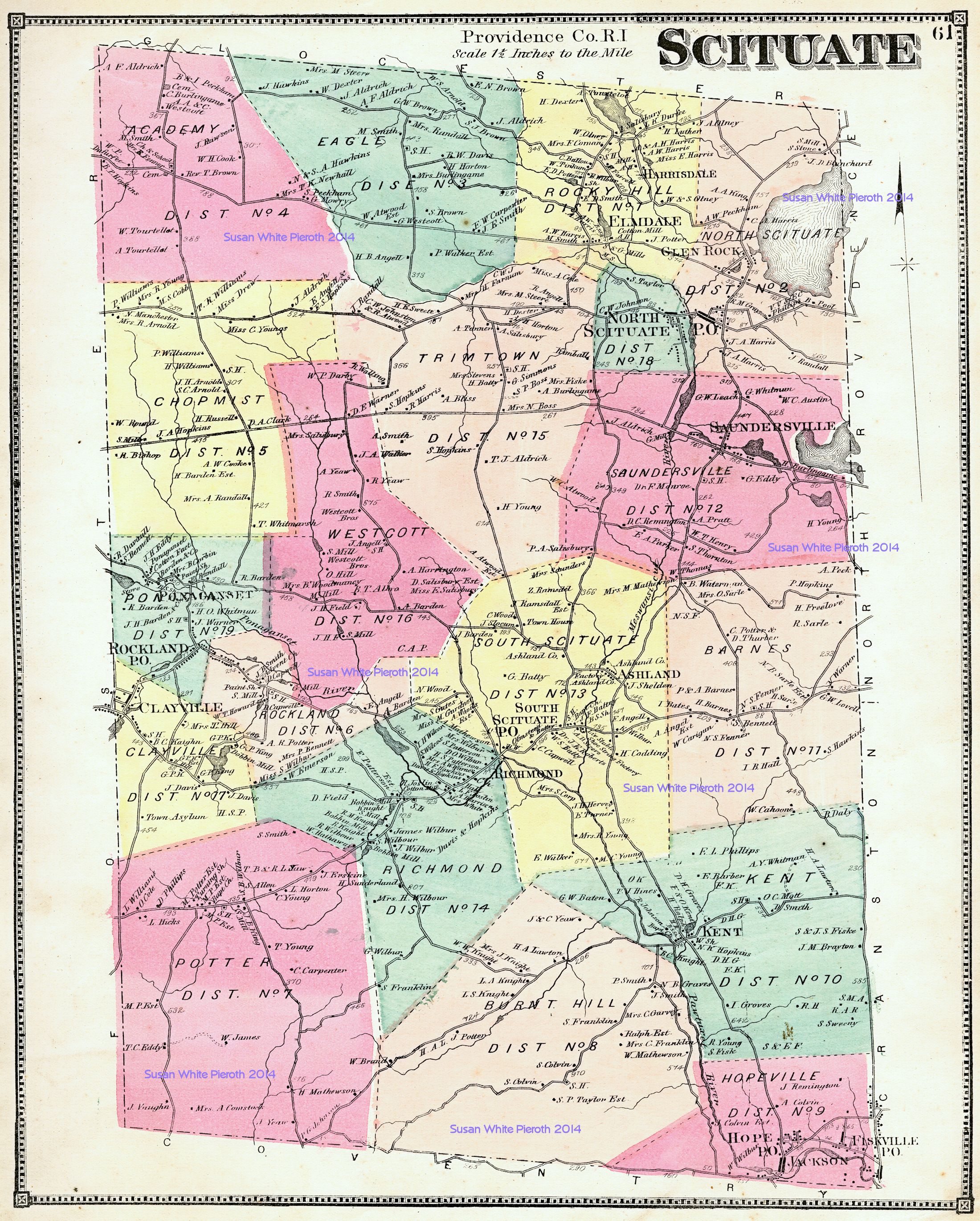 |
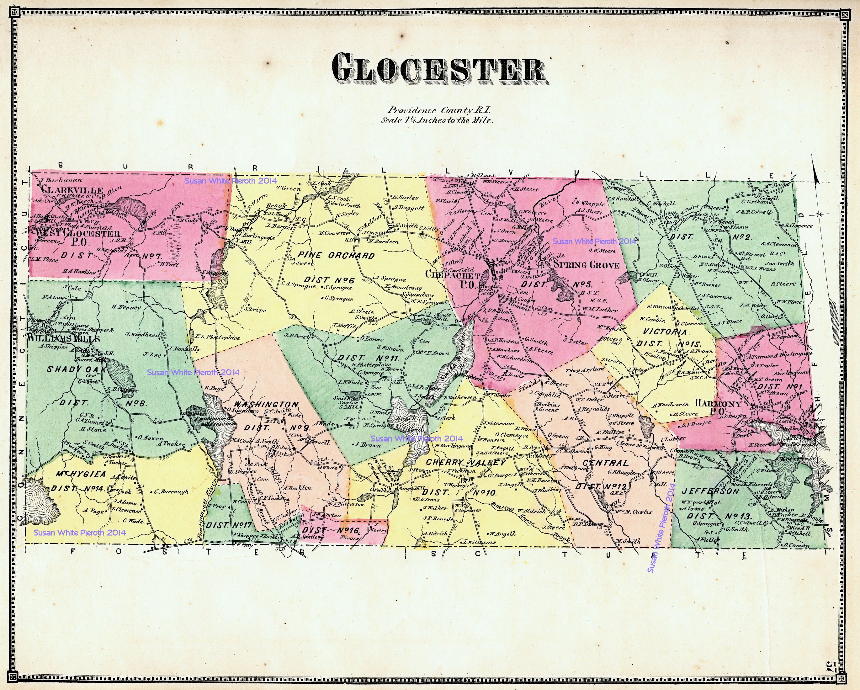
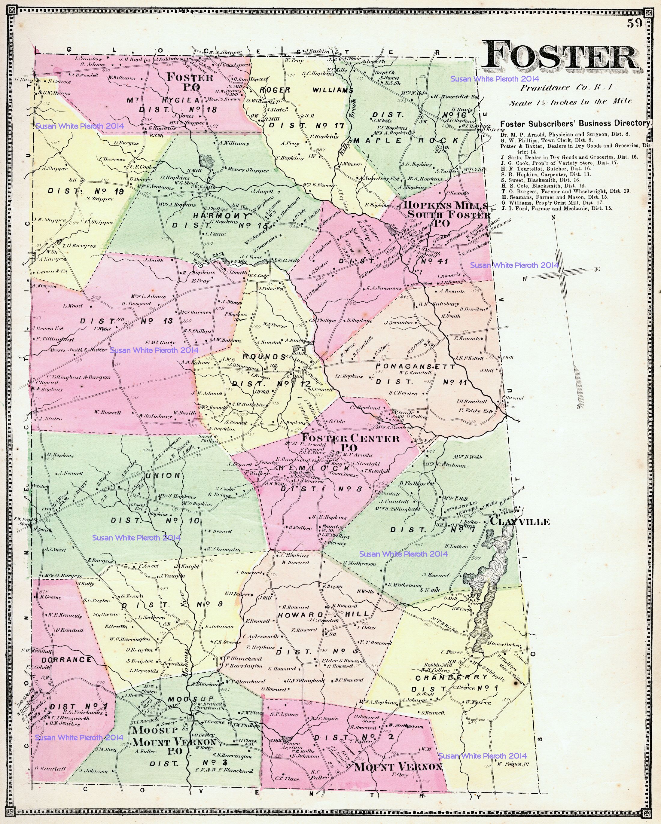
| Glocester: page 57 | Foster: page 59 | Scituate: page 61 |
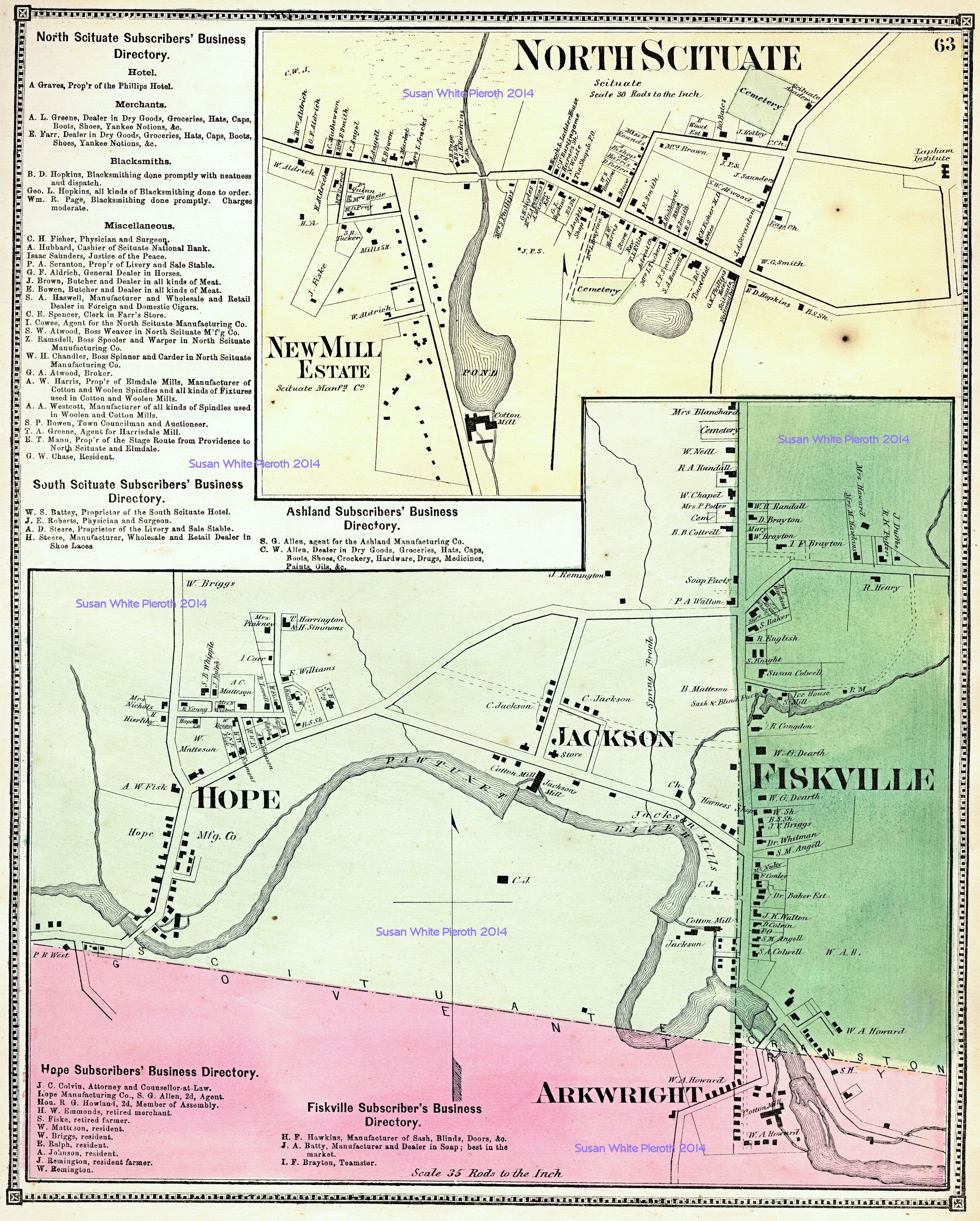 |
North Scituate, including enlargements of New Mill Estate, Hope, Jackson, Arkwright, and Fiskville: page 63 |
 |
 |
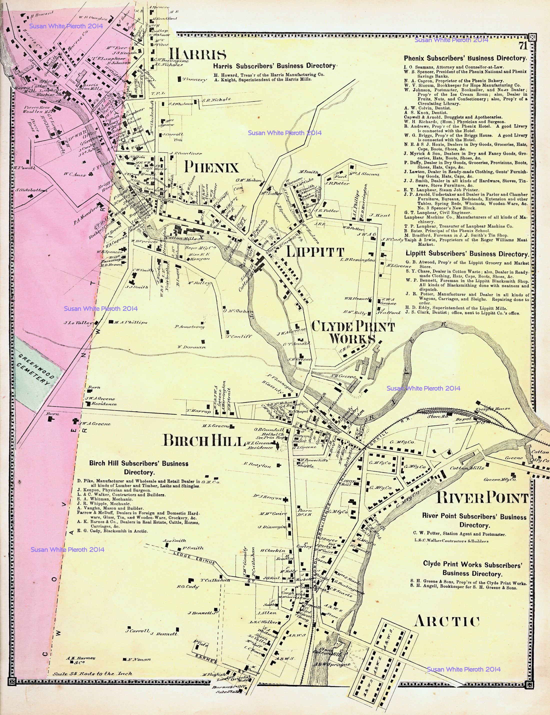 |
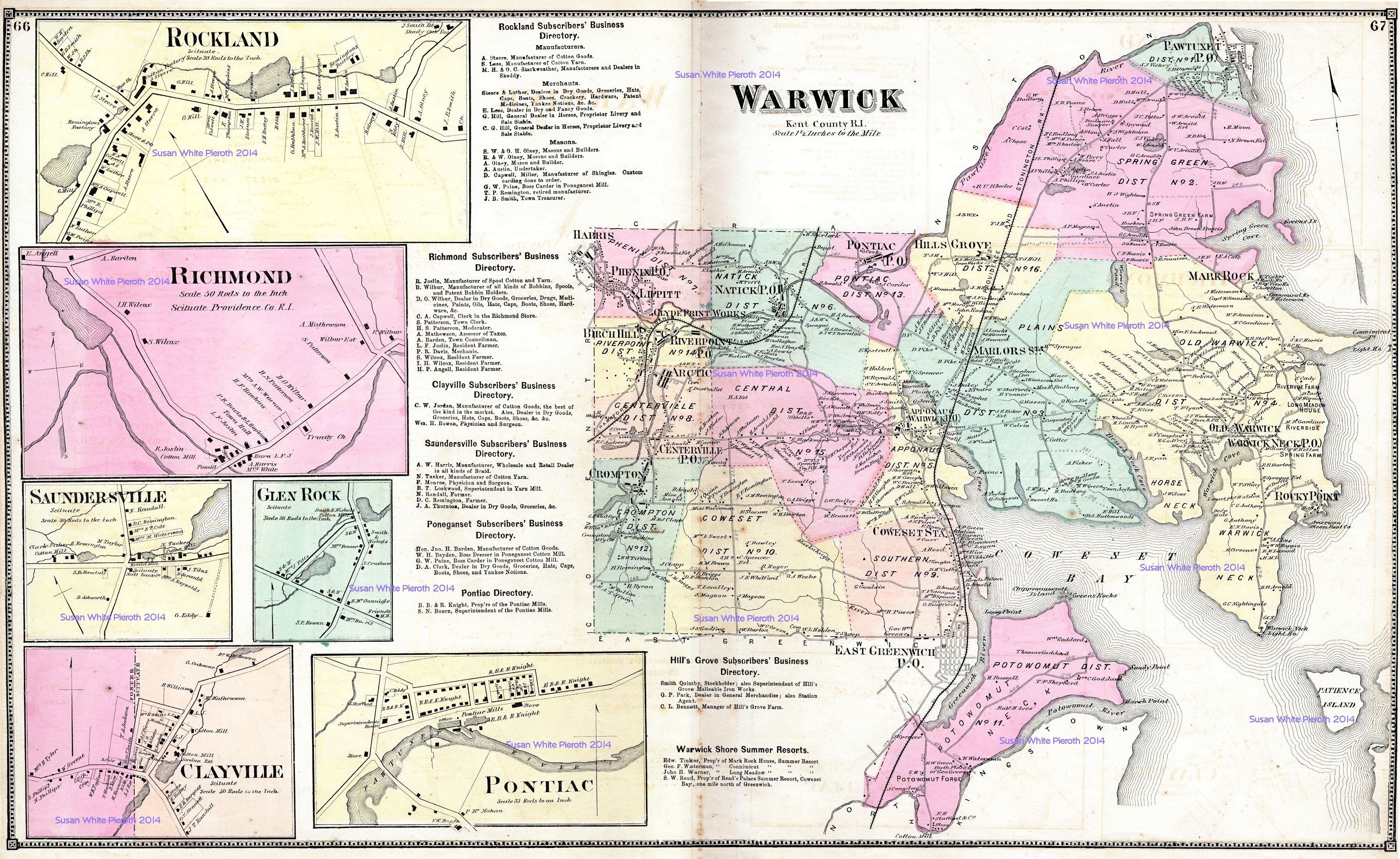
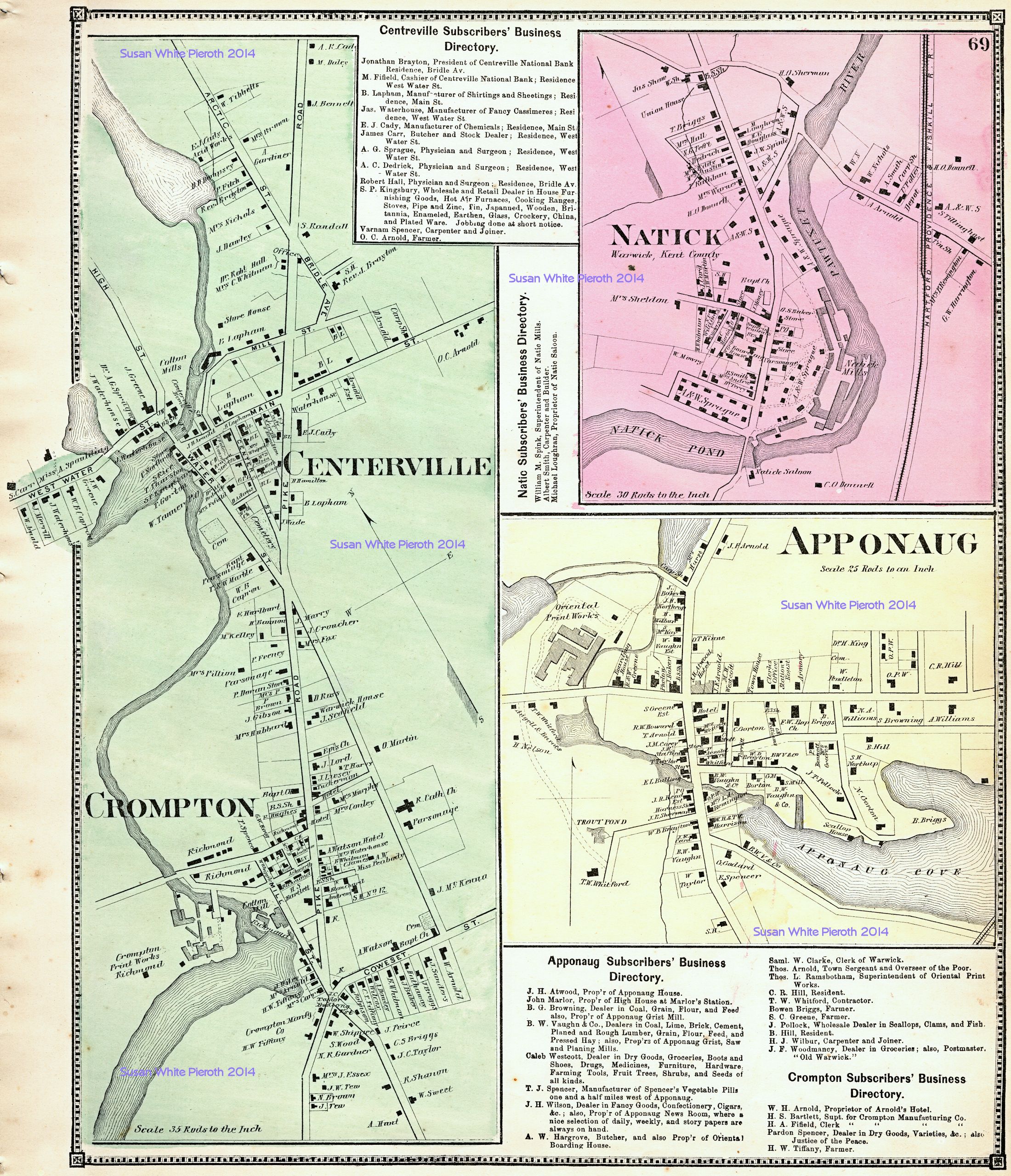
| Rockland, Richmond, Saundersville, Clayville, Glen Rock, Pontiac and Warwick: page 66 and 67 | Apponaug, Centerville, Crompton, and Natick: page 69 | Arctic, Birch Hill, Clyde Print Works, Harris, Lippitt, Phenix, and River Point: page 71 |
 |
 |
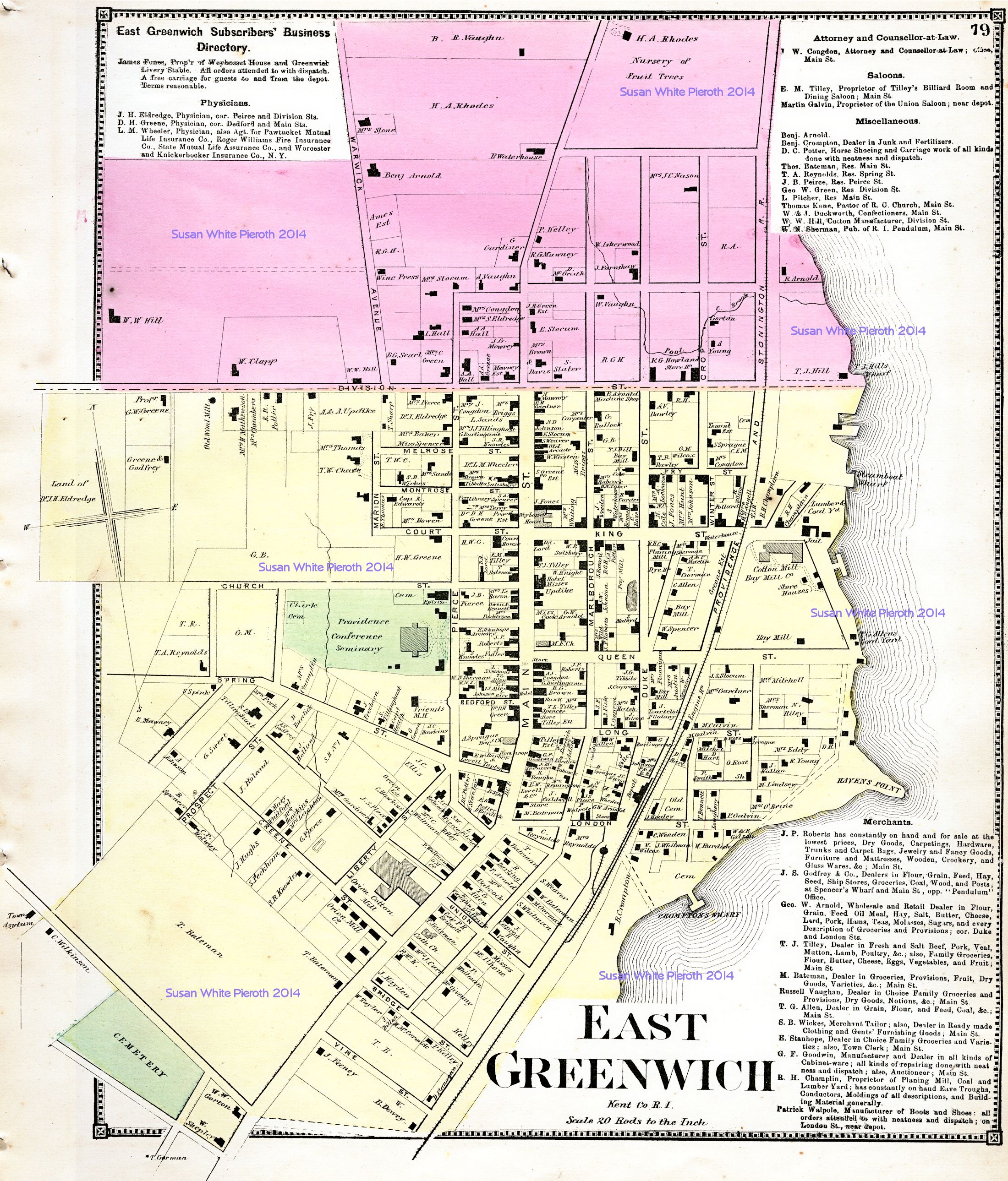 |
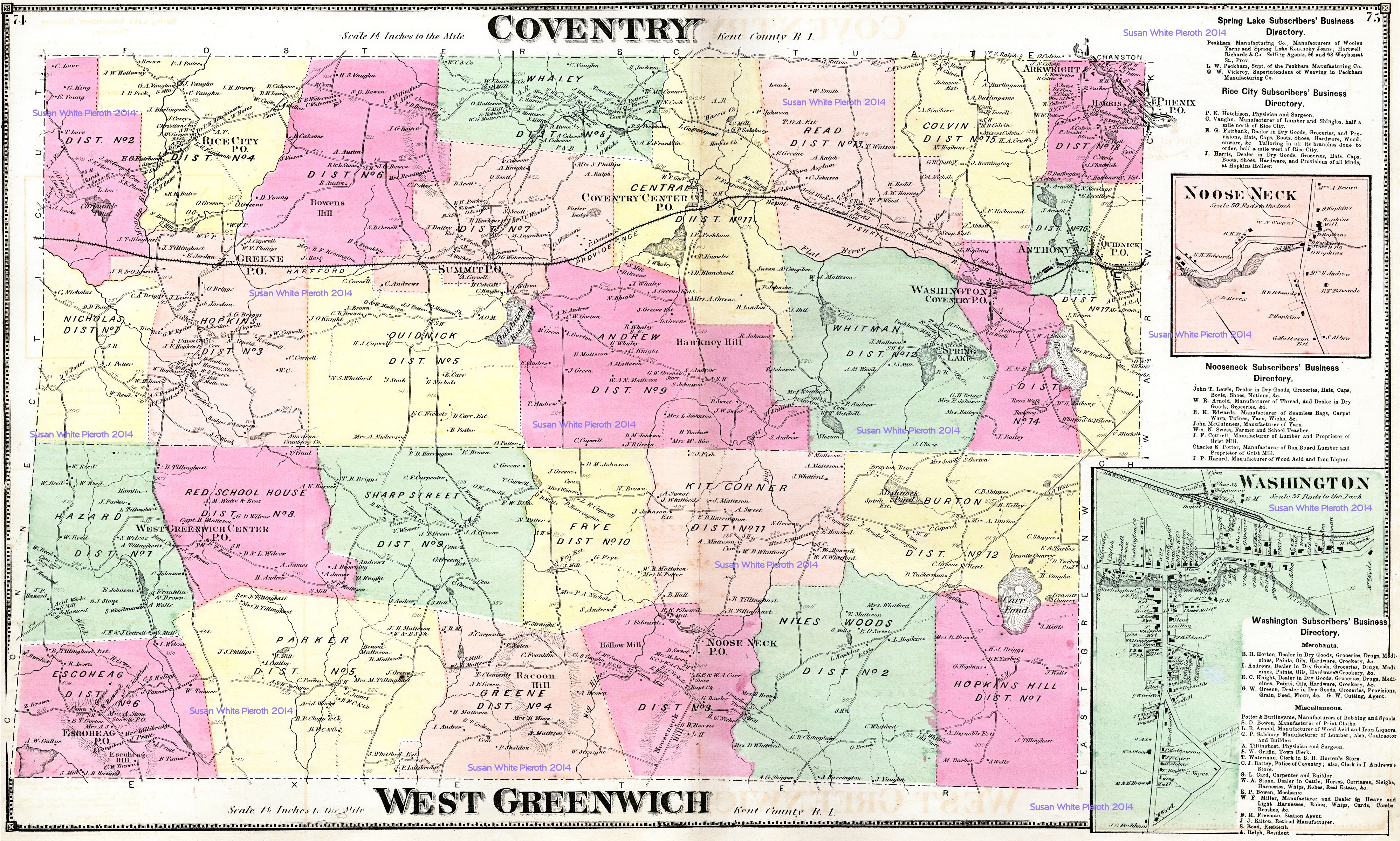
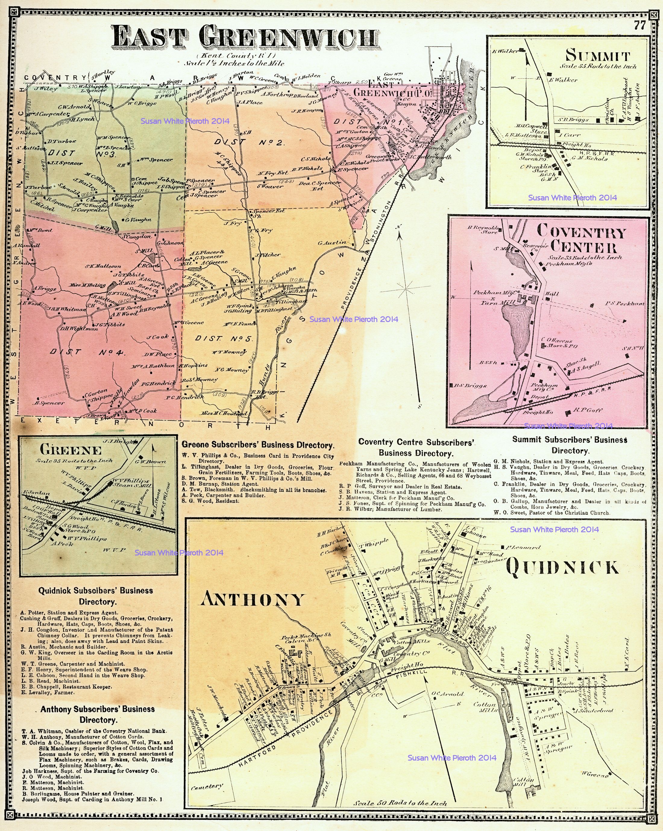
| Coventry and West Greenwich, plus enlargements of Noose Neck and Washington: page 74 and 75 | East Greenwich, plus enlargements of Anthony, Coventry Center, Greene, Quidnick, and Summit: page 77 | East Greenwich enlarged: page 79 |
 |
 |
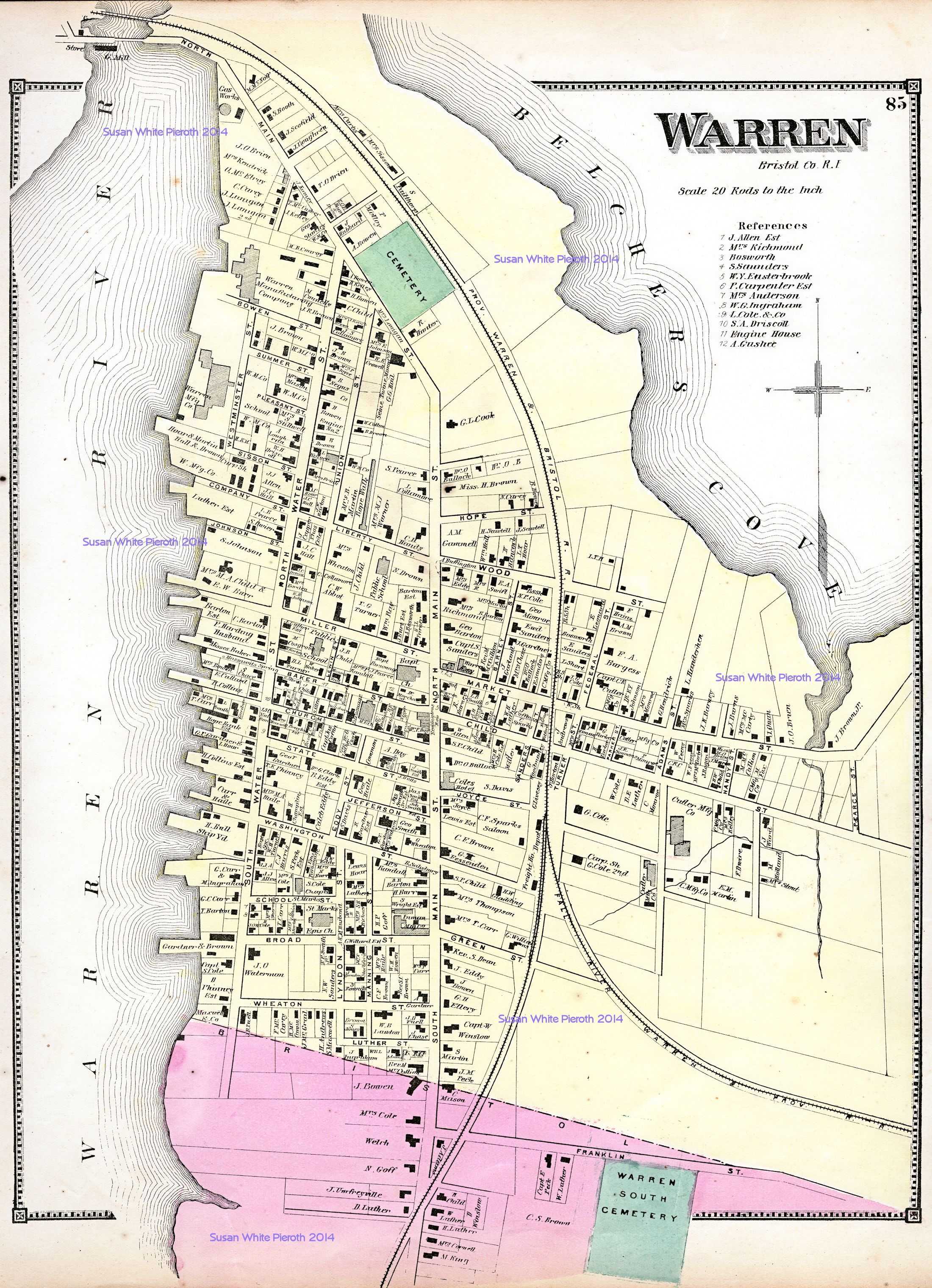 |
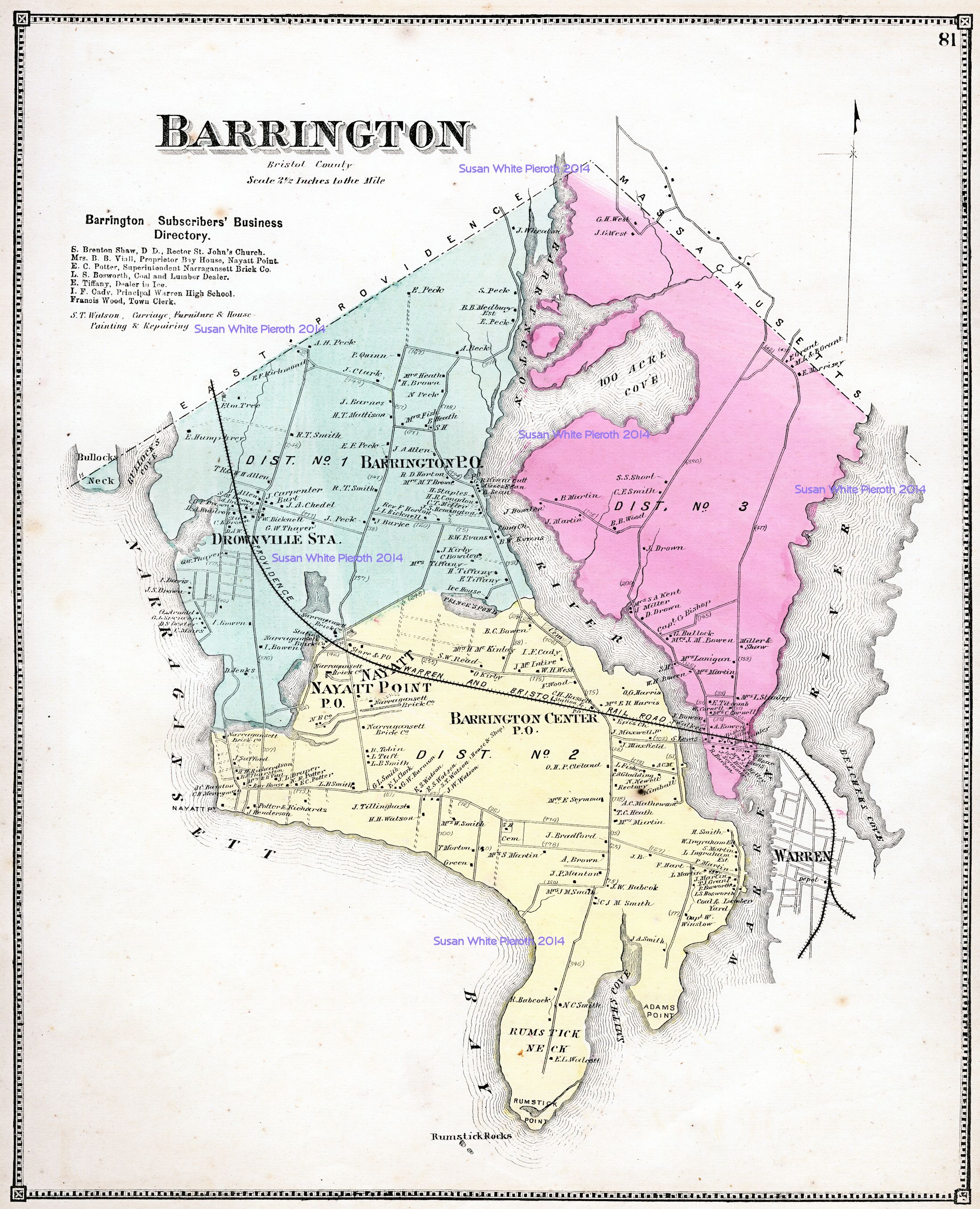
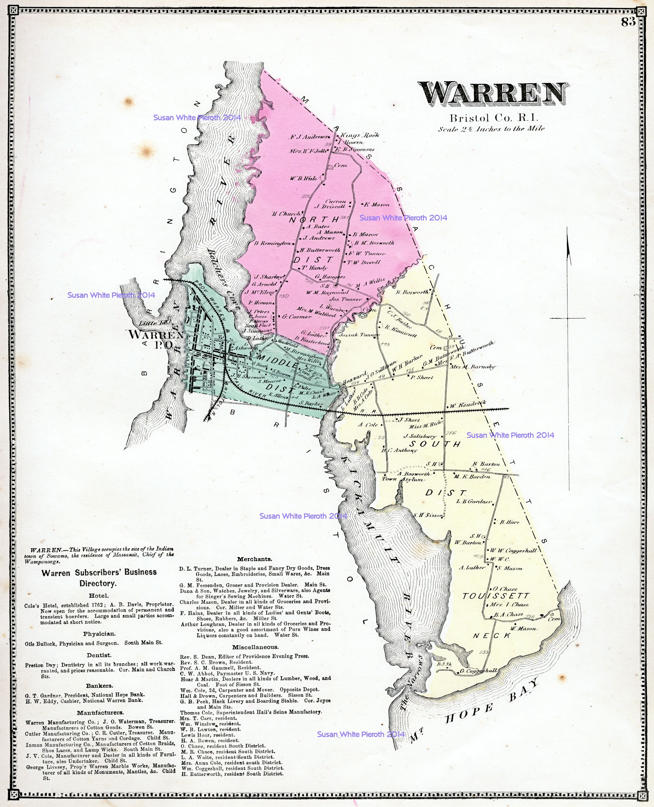
| Barrington: page 81 | Warren: page 83 | Warren enlarged: page 85 |
 |
 |
|
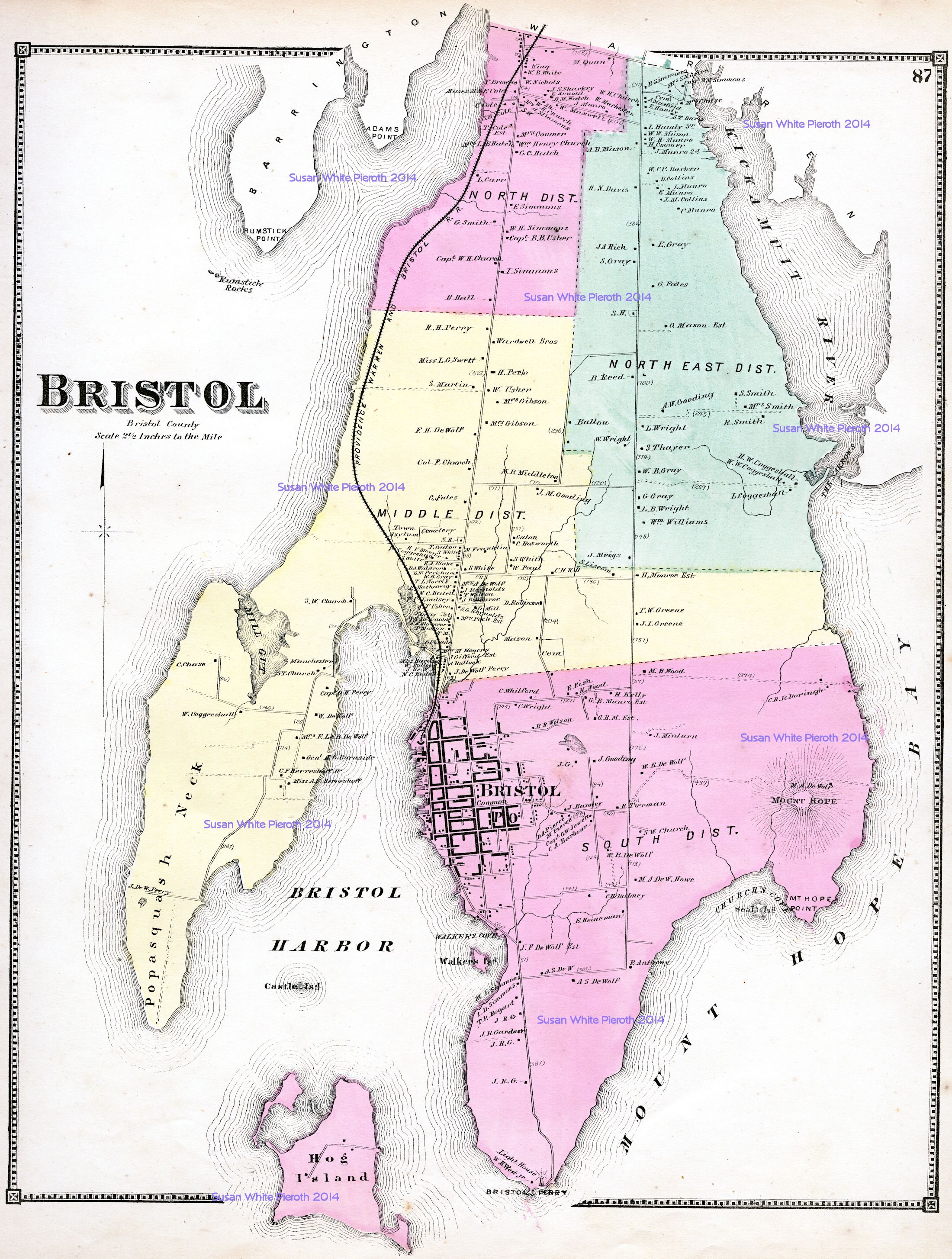
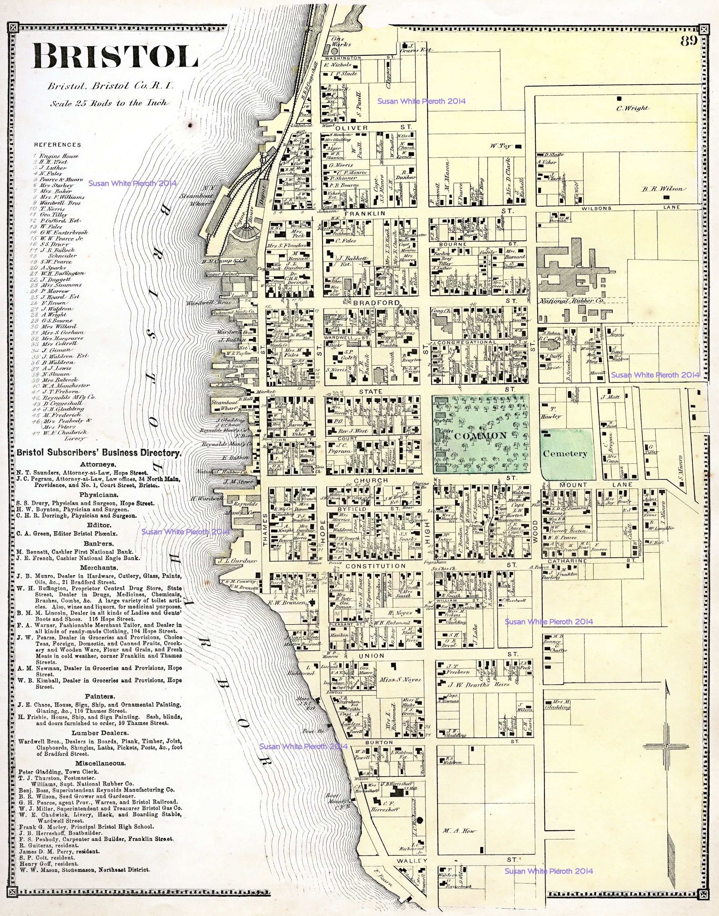
| Bristol: page 87 | Bristol enlarged: page 89 |
 |
 |
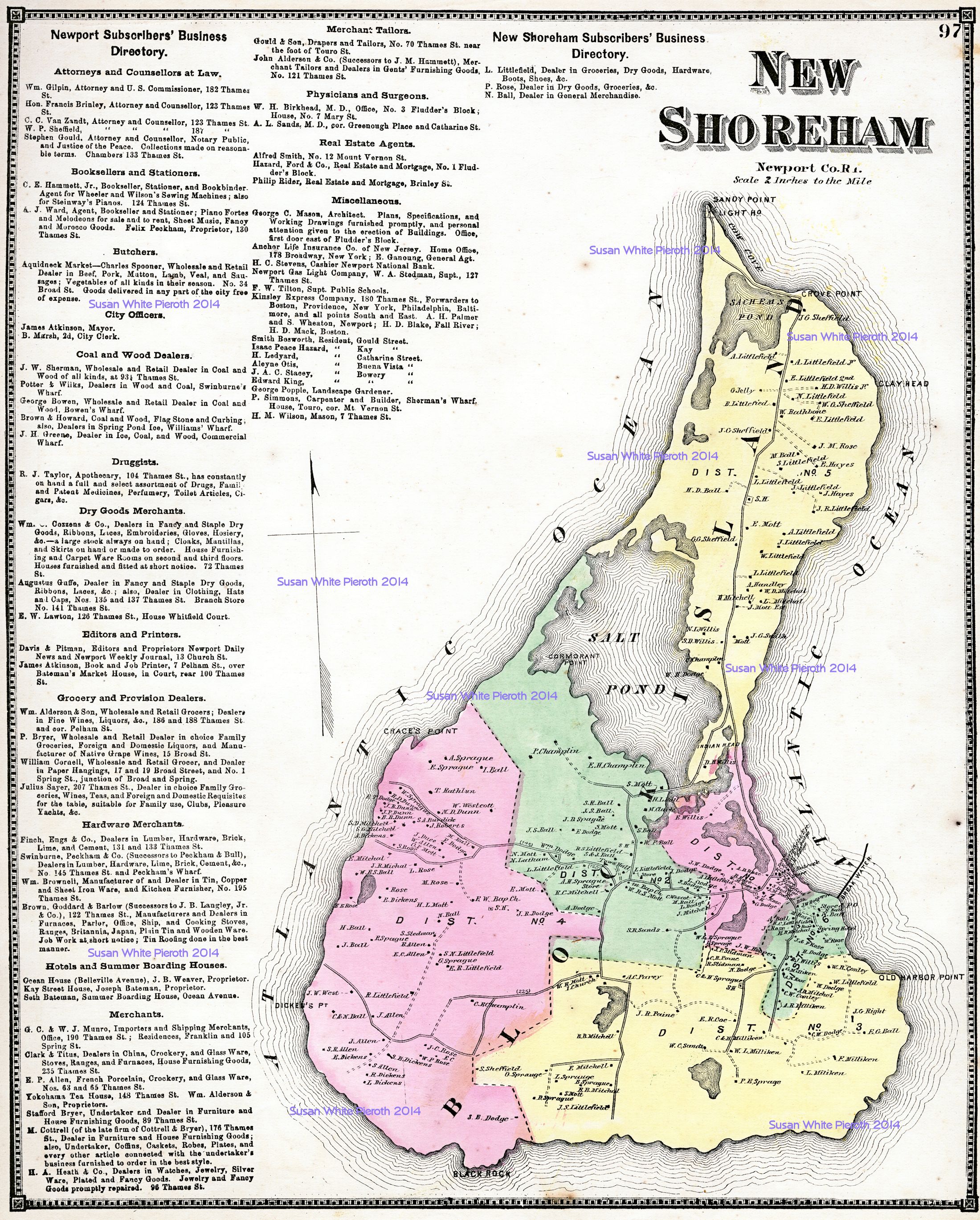 |
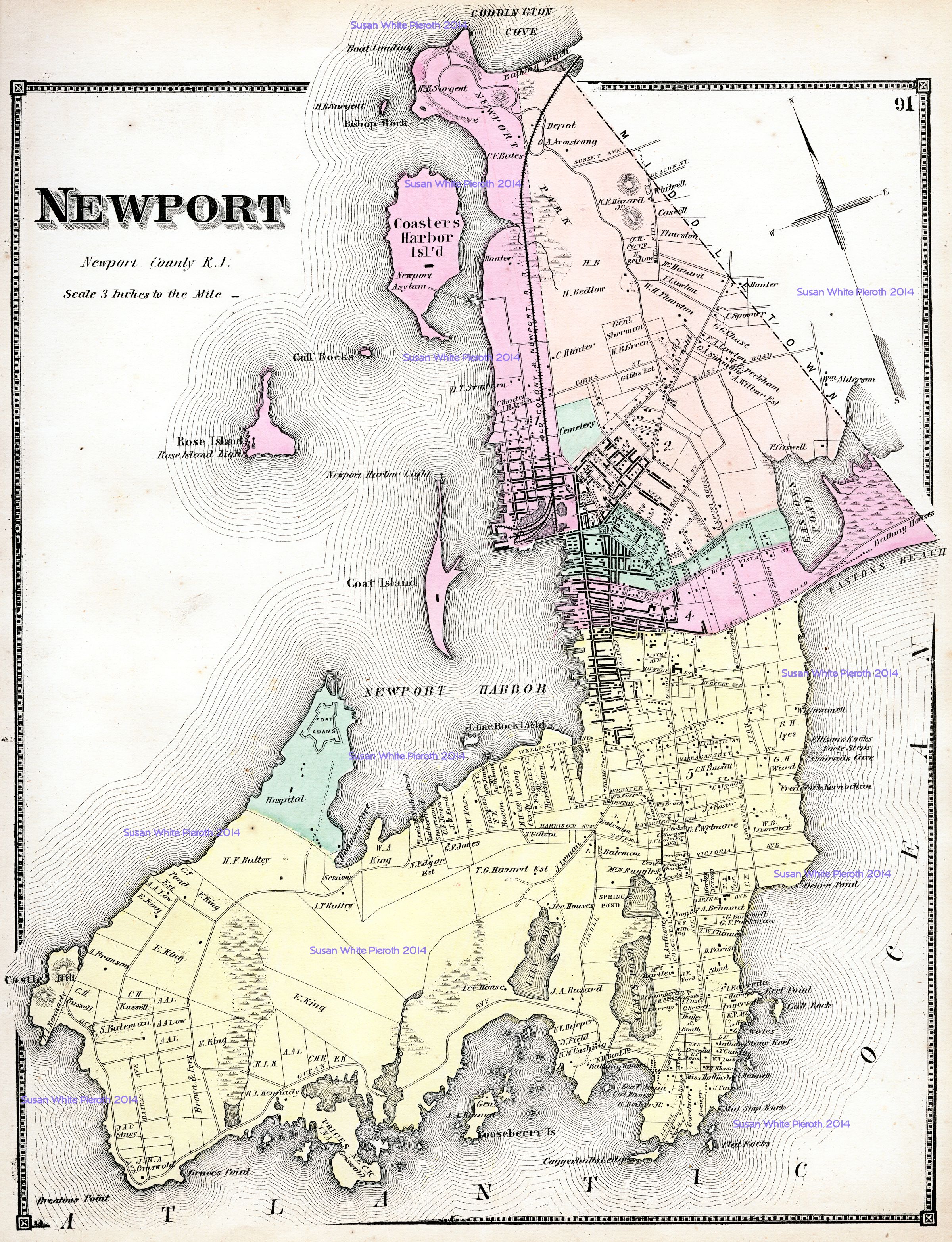
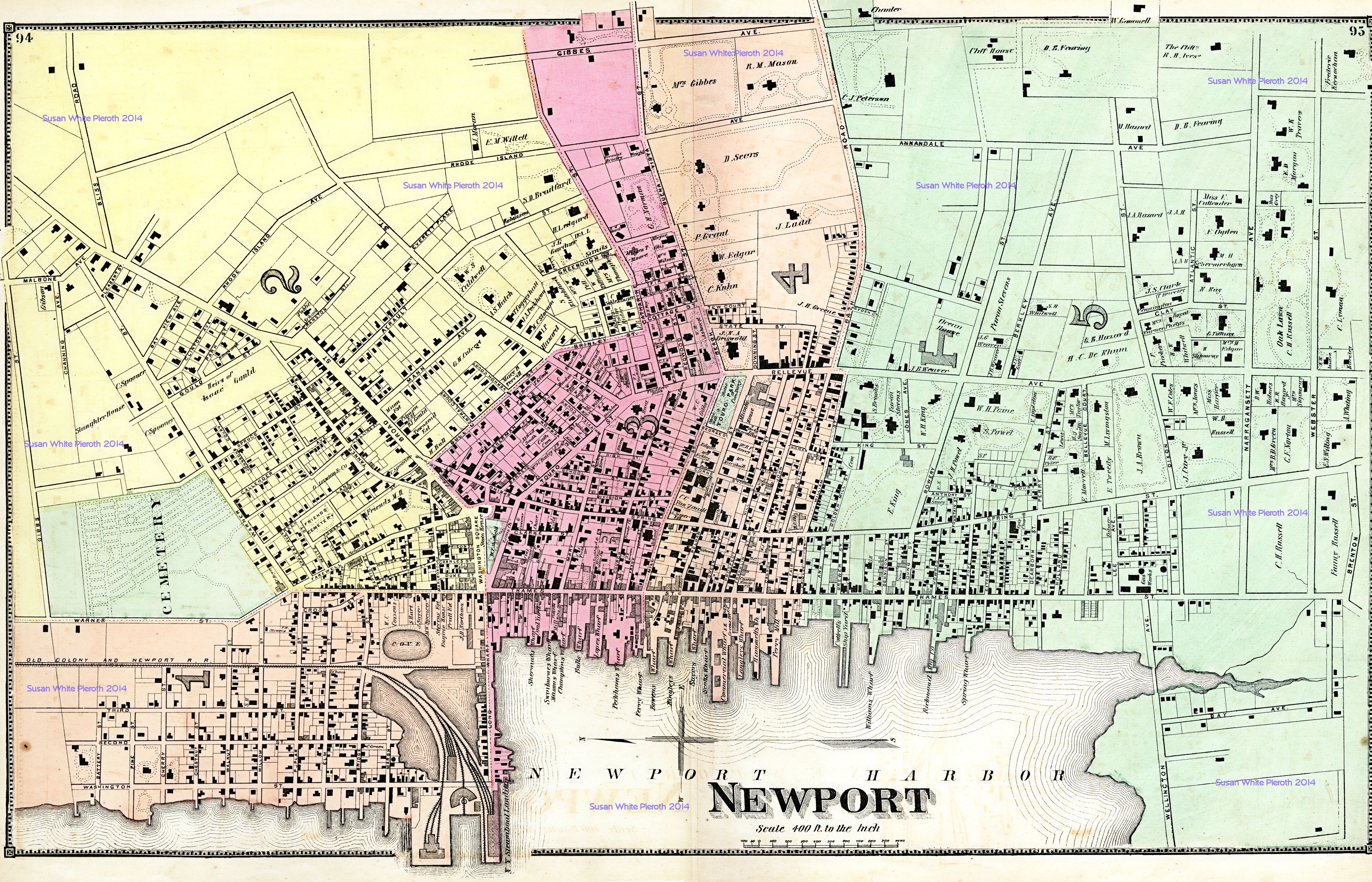
| Newport City and Islands: page 91 | Newport City enlarged: pages 94 and 95 | Block Island and New Shoreham (now Washington County): page 97 |
 |
 |
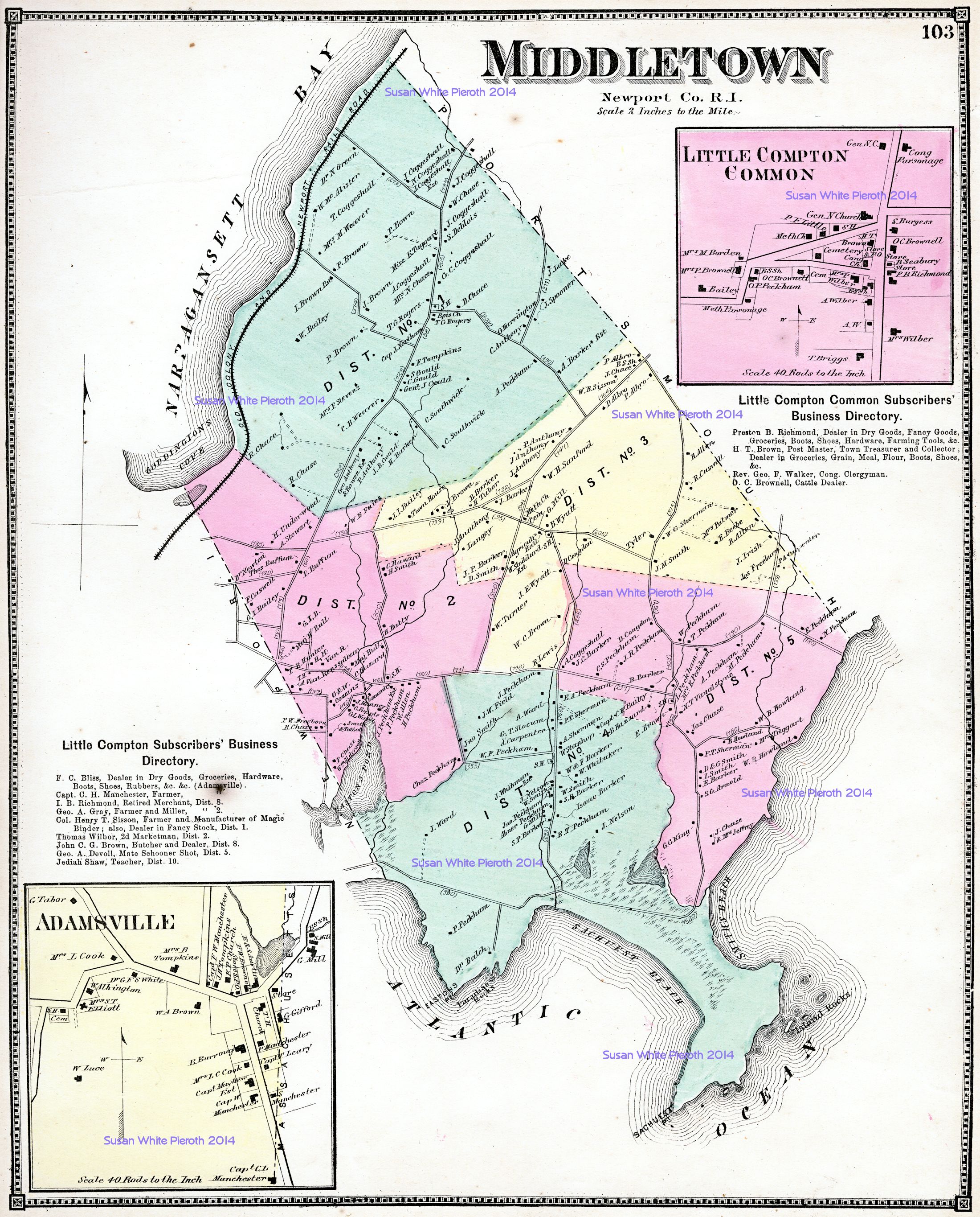 |
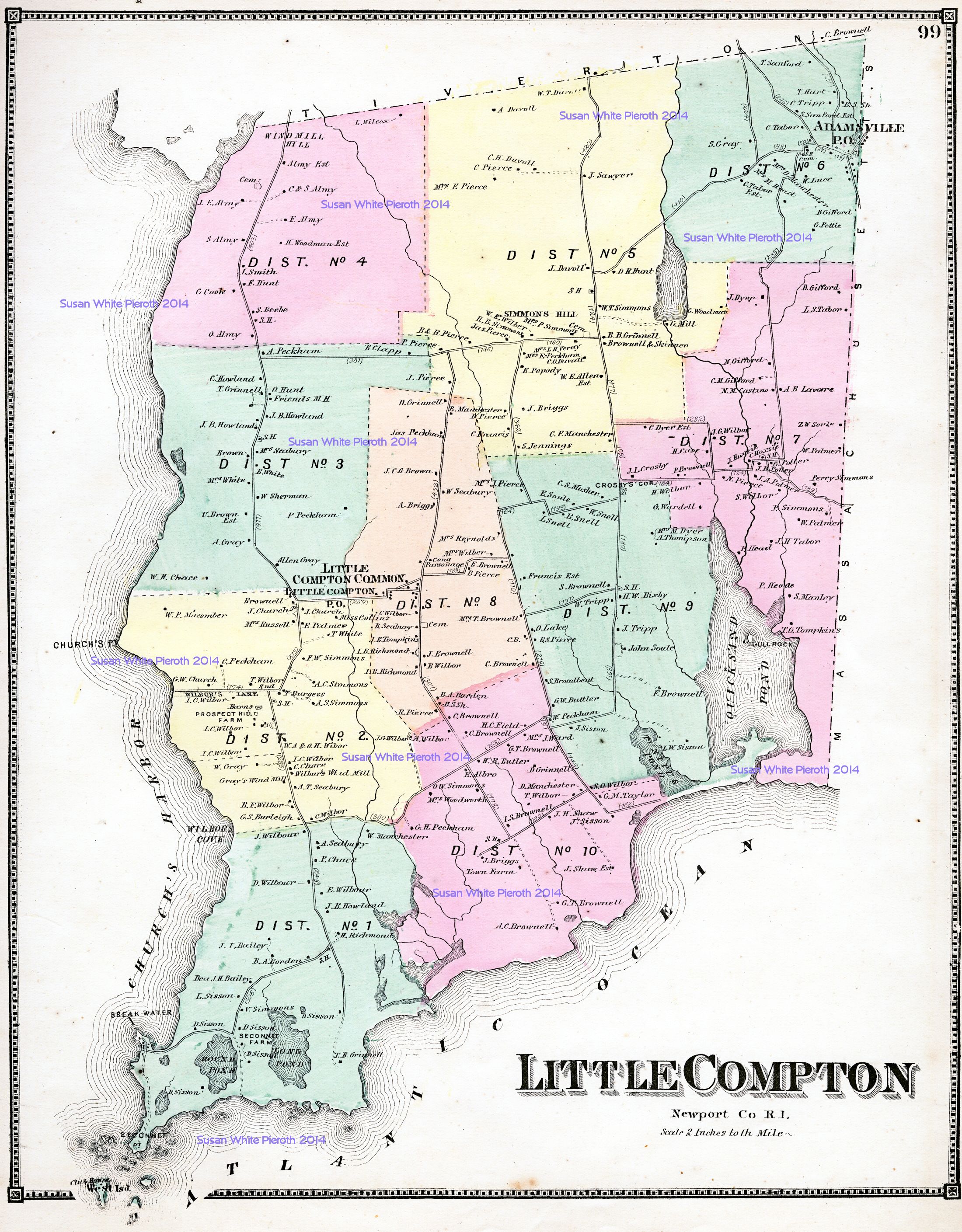
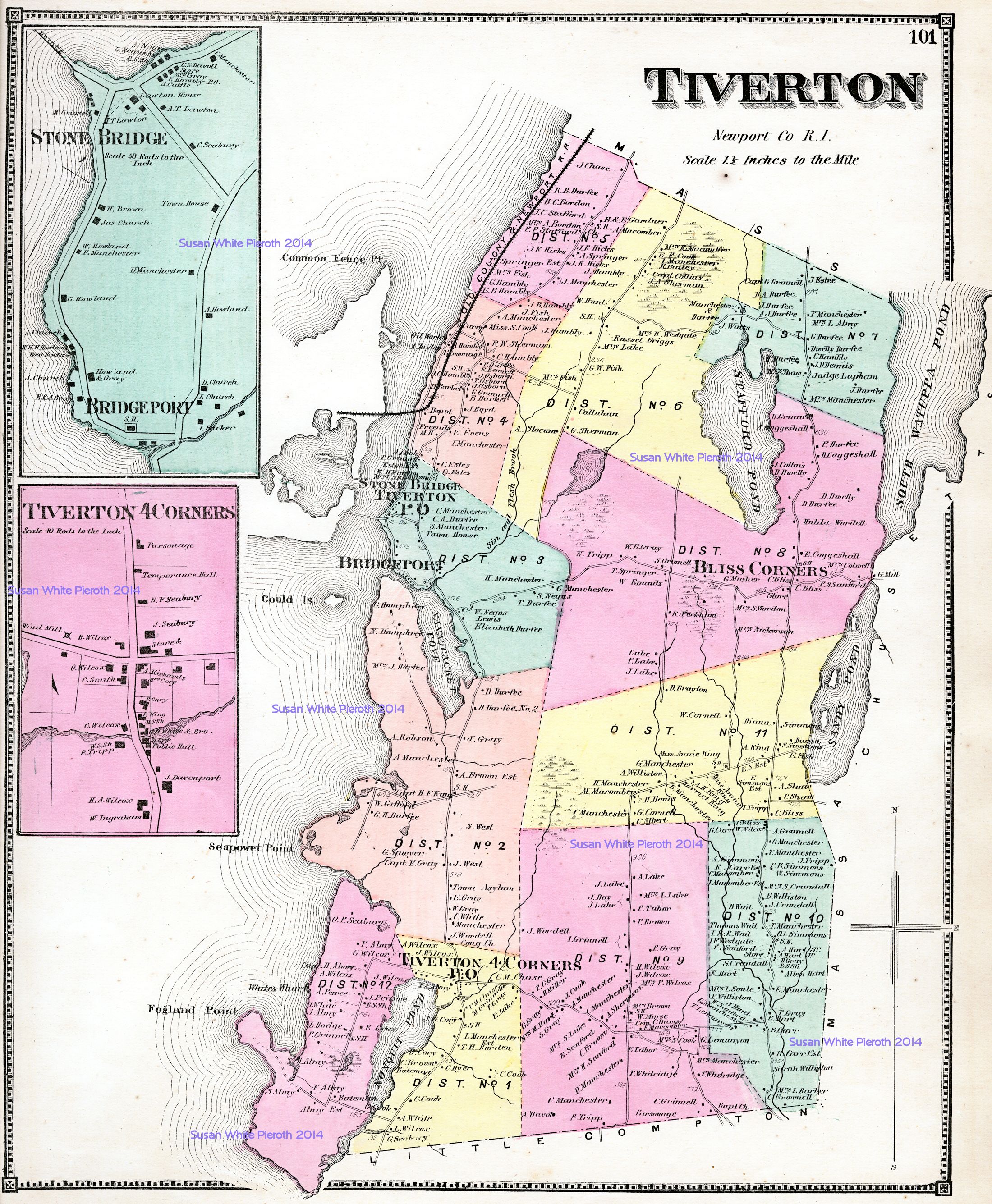
| Little Compton: page 99 | Tivertons, Stone Bridge, Bridgeport, and Tiverton 4 Corners: page 101 | Middletown, Little Compton Common and Adamsville: page 103 |
 |
 |
|
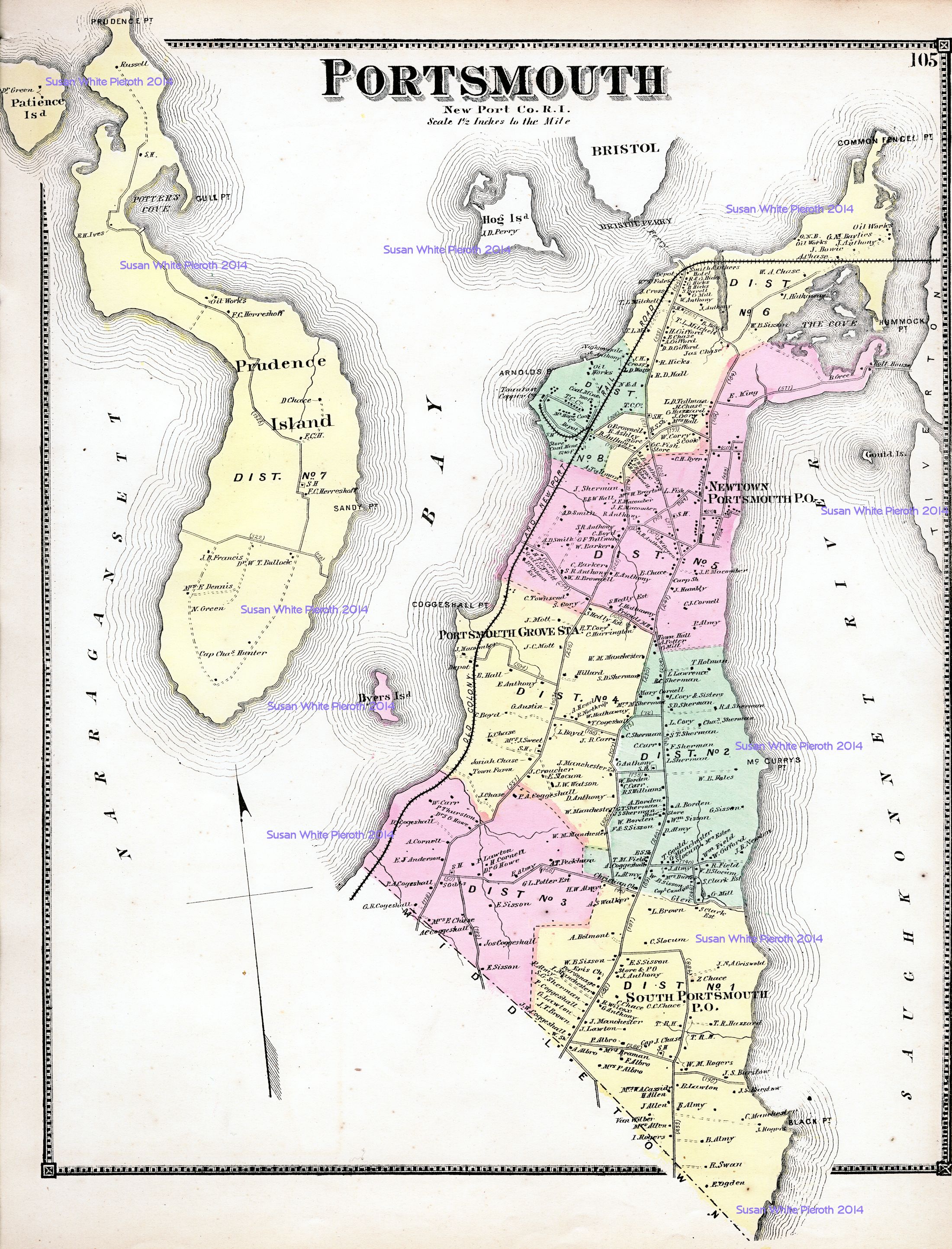
| Portsmouth, Prudence and Patience Islands: page 105 | Jamestown (Connanicut Island), Newtown, Portsmouth: page 107 |
 |
 |
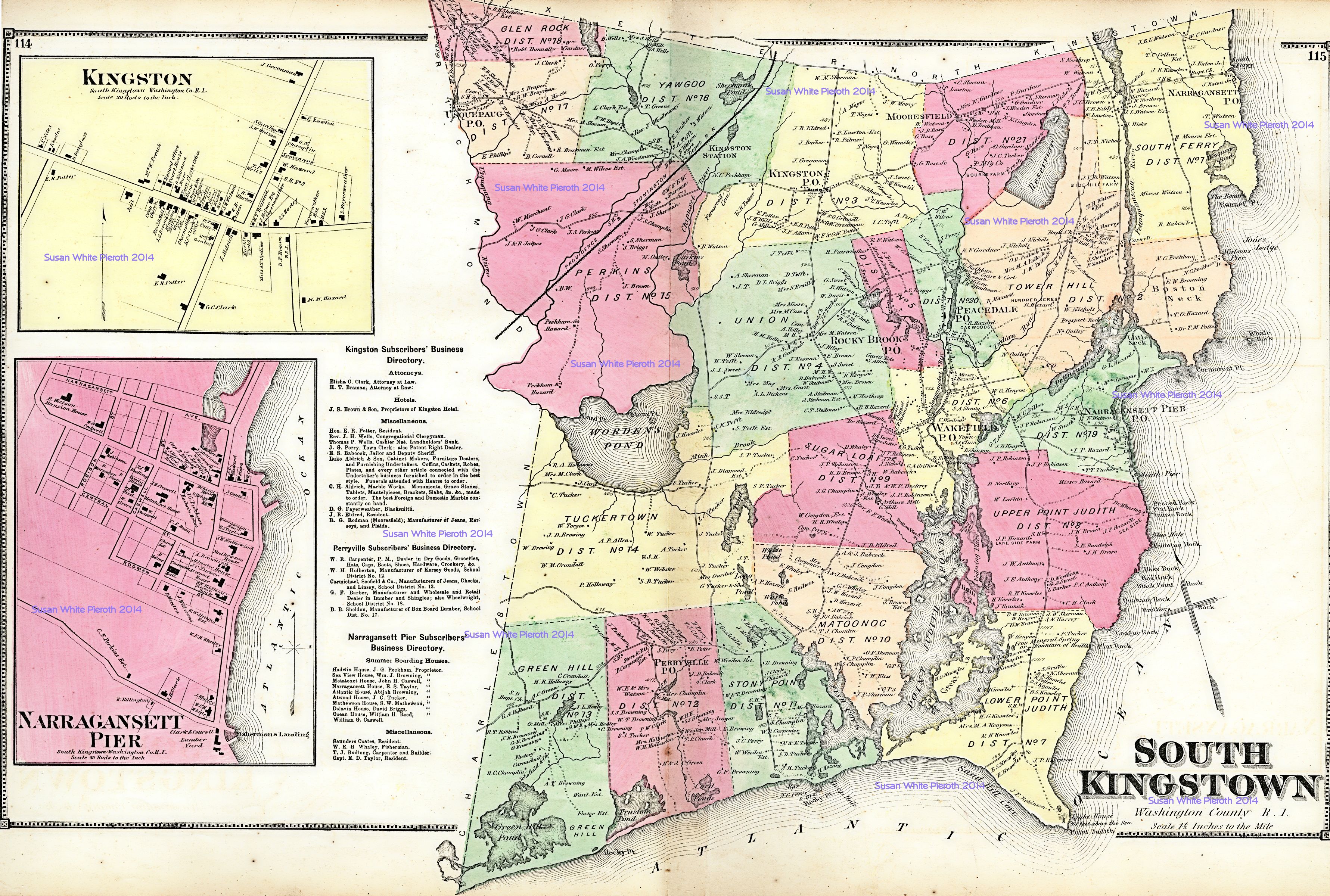 |
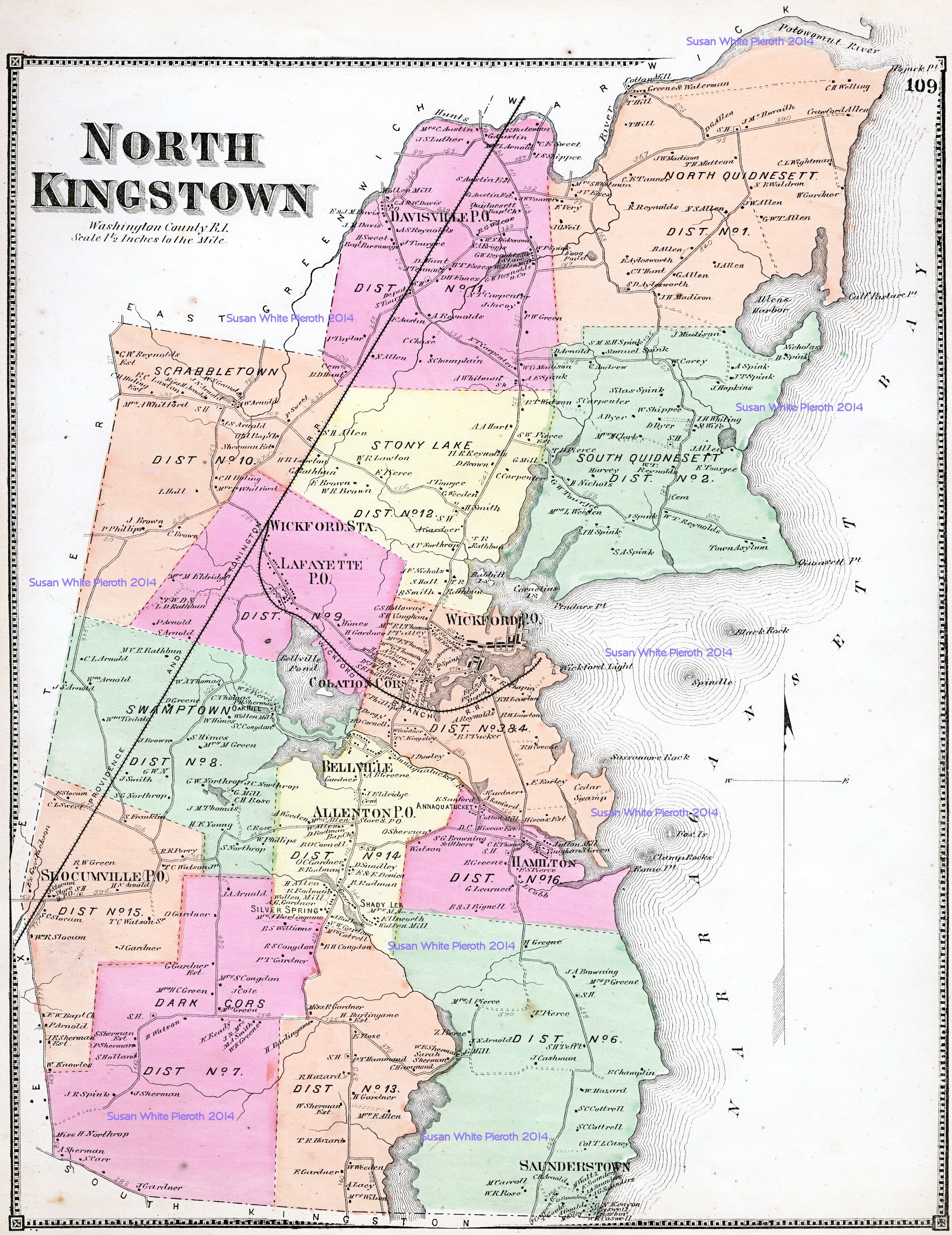
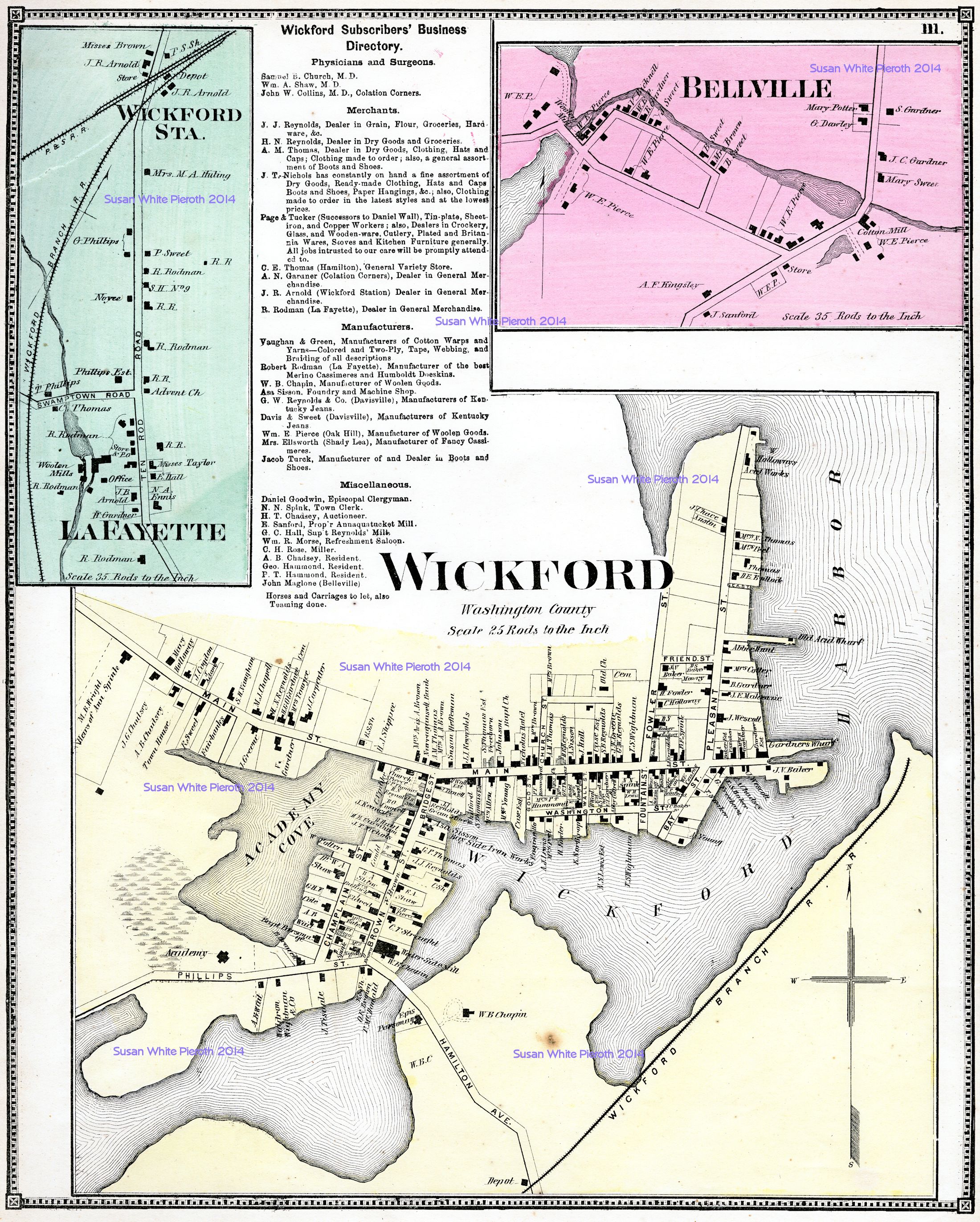
| North Kingstown: page 109 | Wickford, Bellville, LaFayette, Wickford Station: page 111 | Kingston and Narragansett Pier, South Kingstown: page 114 and 115 |
 |
 |
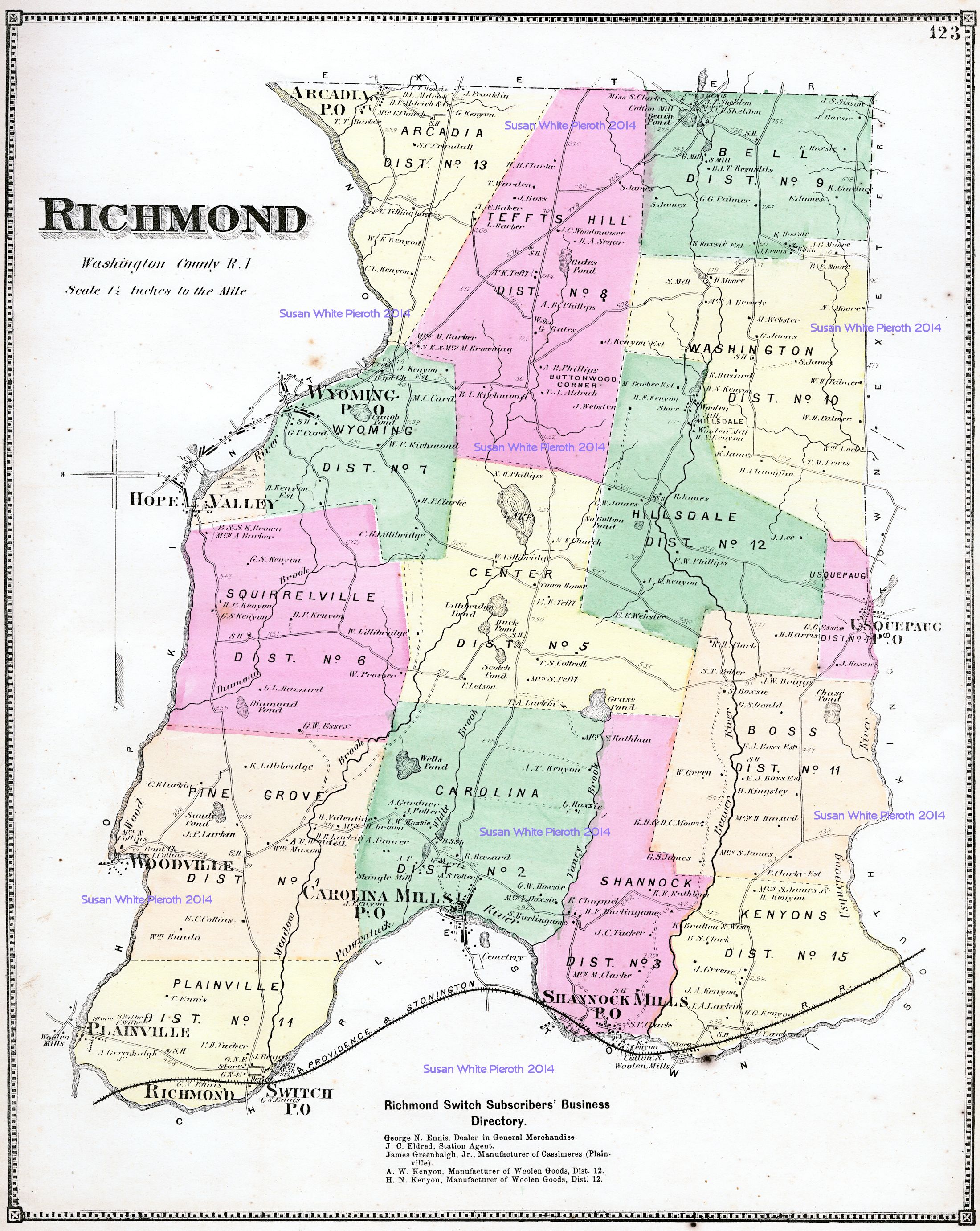 |
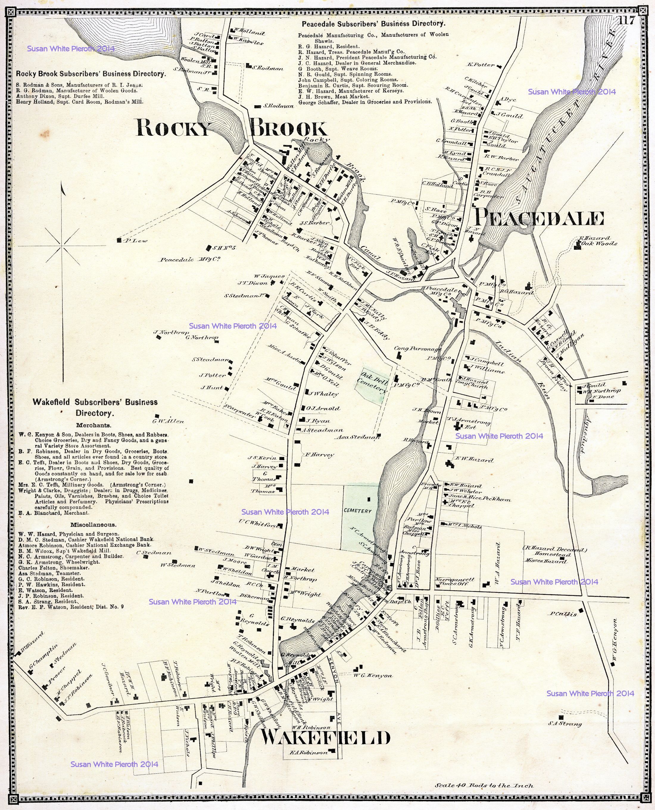
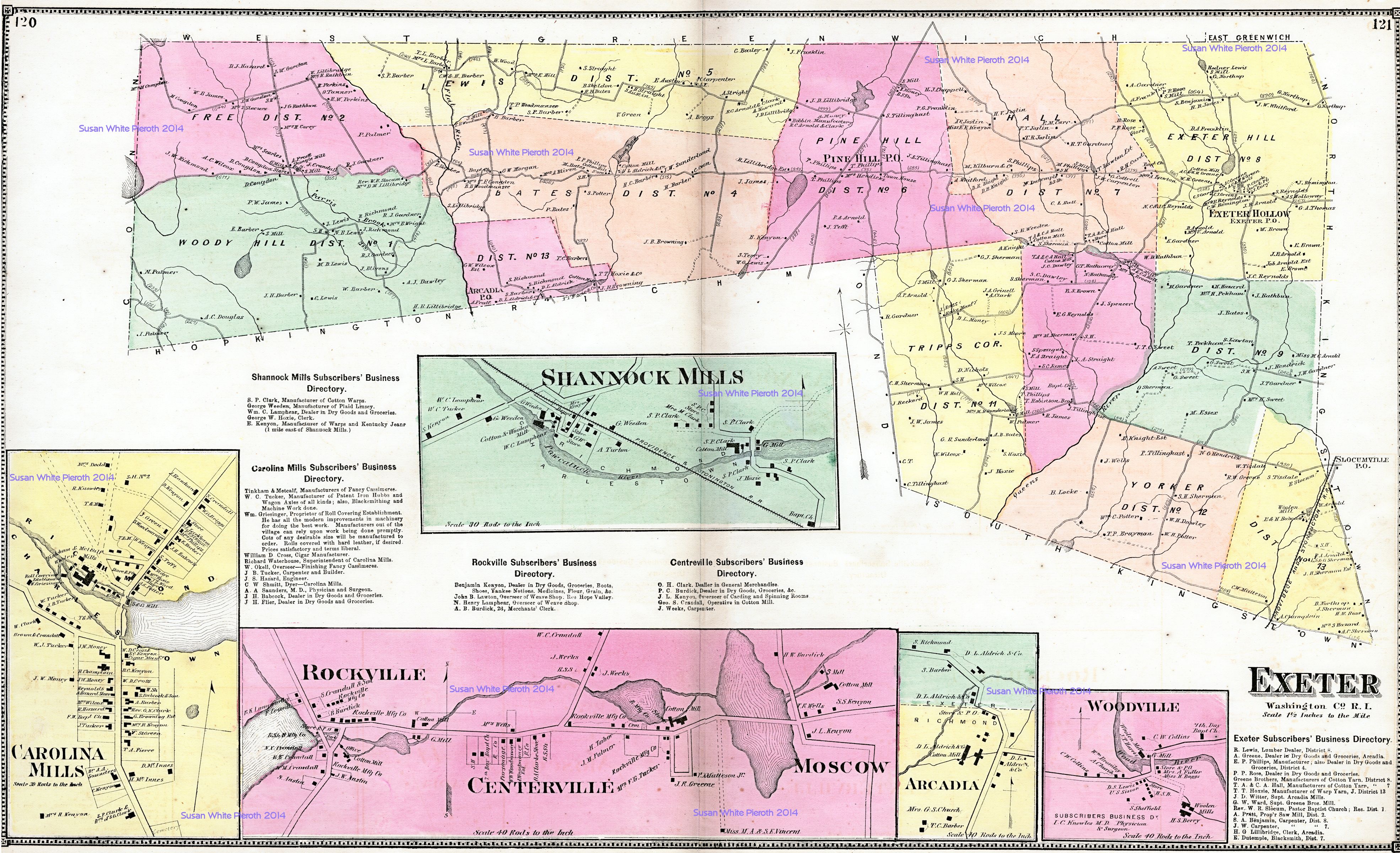
| Enlargements of Rocky Brook, Peacedale, and Wakefield: page 117 | Exeter, Carolina Mills, Centerville, Moscow, Rockville, Shannock Mills and Woodville: pages 120 and 121 | Richmond: page 123 |
 |
 |
 |
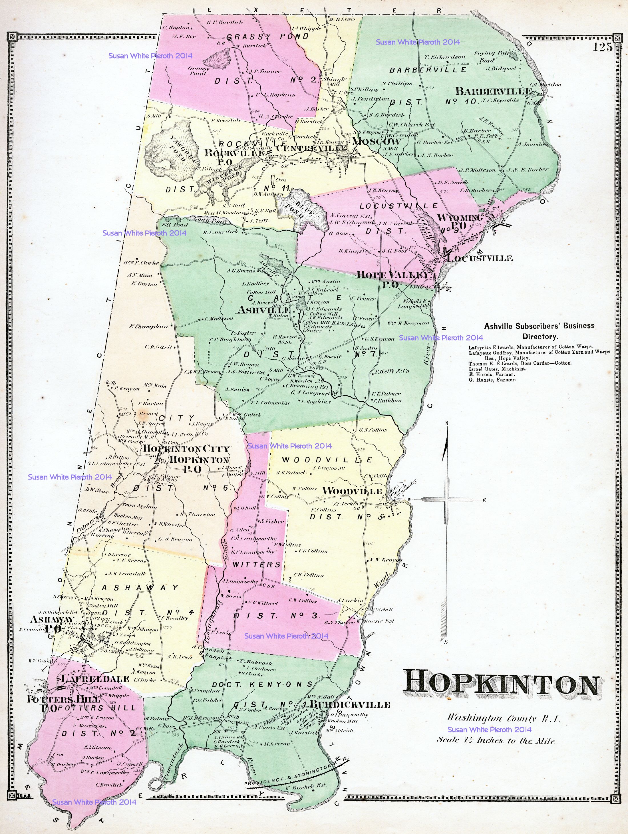
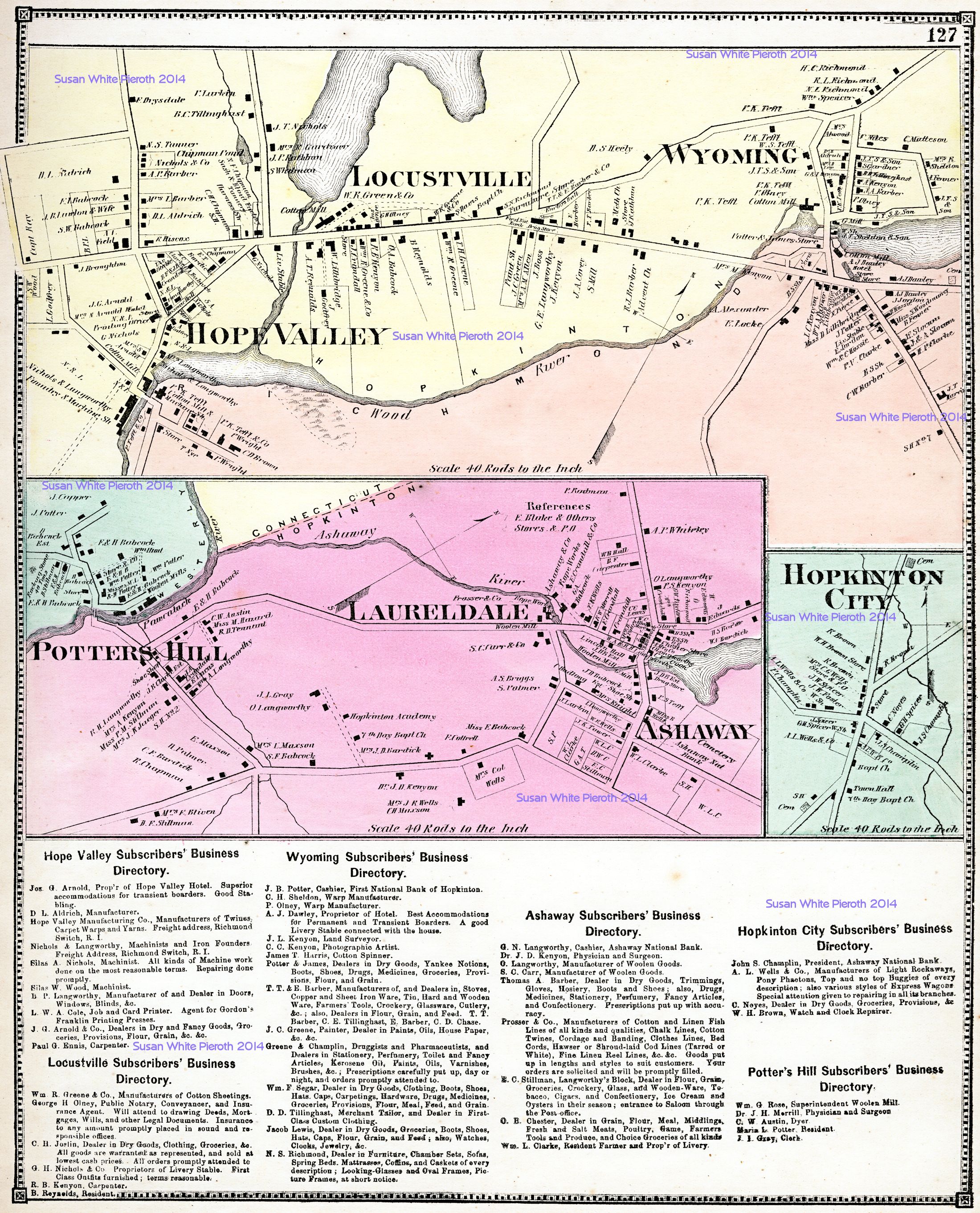
| Hopkinton: page 125 | Ashaway, Hope Valley, Hopkinton City, Laureldale, Locustville, Potters Hill, and Wyoming: page 127 | Charlestown, plus an enlargement of Dorrville: page 129 |
 |
 |
|
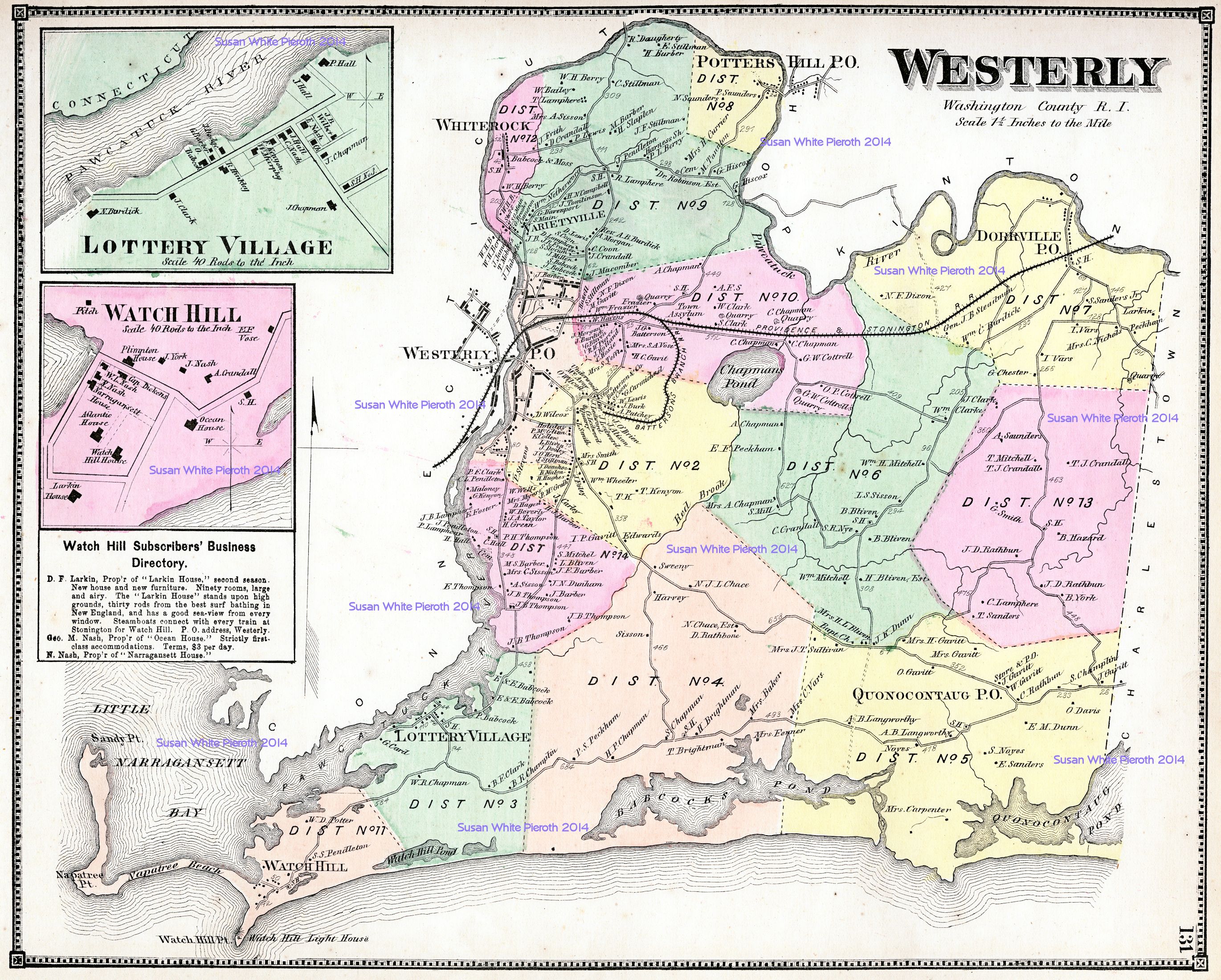
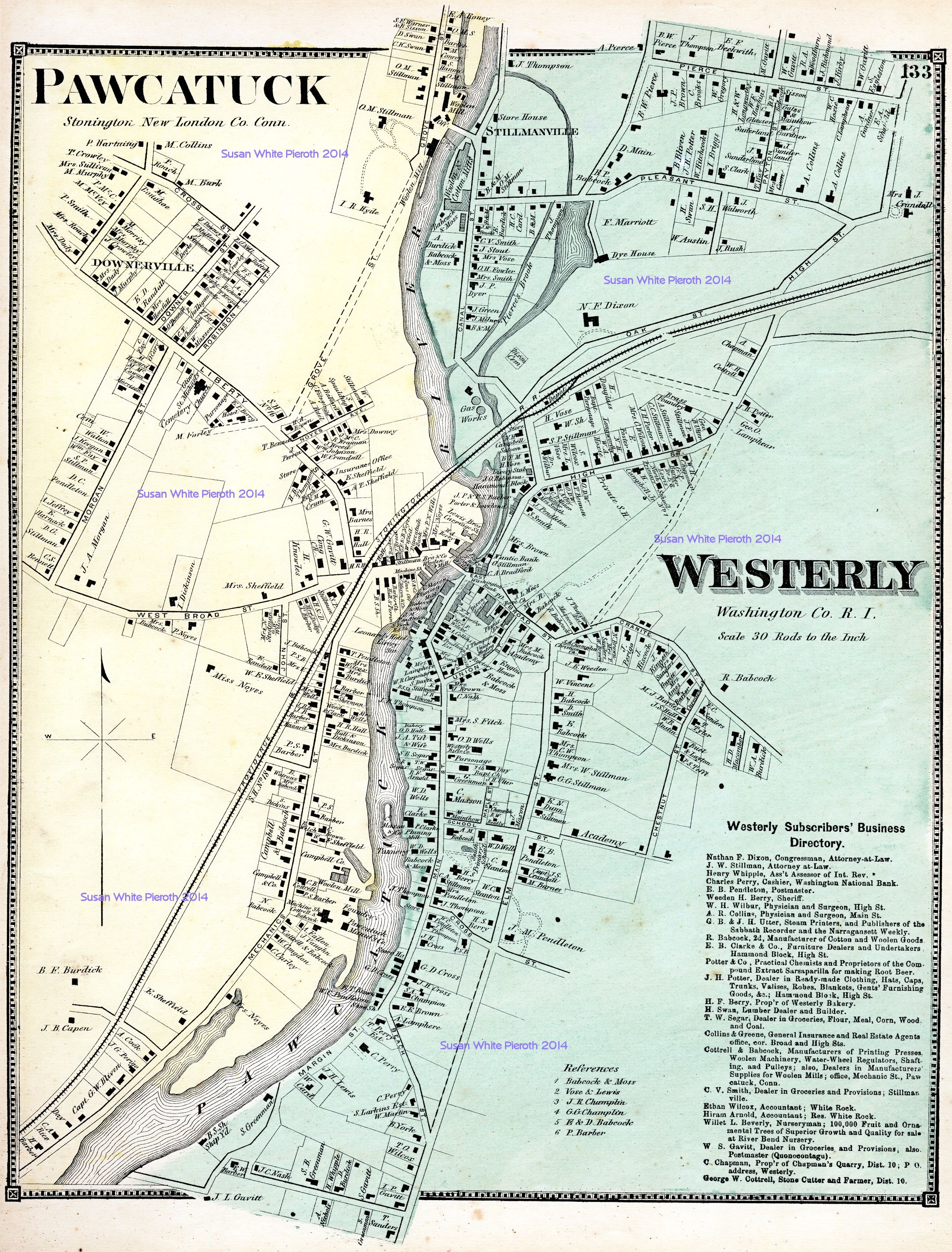
| Westerly, plus enlargements of Lotter Hill, and Watch Hill: page 131 | Westerly enlarged, plus Pawcatuck (Stonington, New London, CT): page 133 |